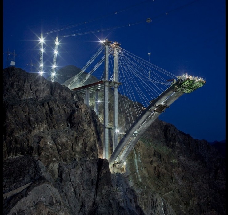
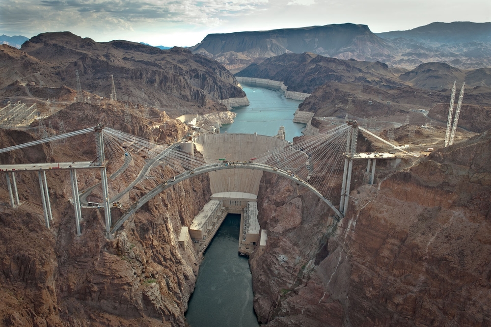
This was sent to me by a friend. Truly a fantastic photo of the bridge construction. The completed bridge has become just as big a tourist attraction as the dam, well almost. The bridge has its own parking lot and viewpoint and provides photo ops of Hoover Dam never-before available to the average person until now. One can access the Dam and Bridge taking the old Hoover Dam road to the visitor center….or if you want a hiking/biking adventure take the Historic Railroad Trail down to the Hoover Dam Parking garage at the visitor center.
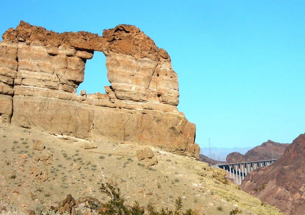
Hike to Liberty Bell Arch
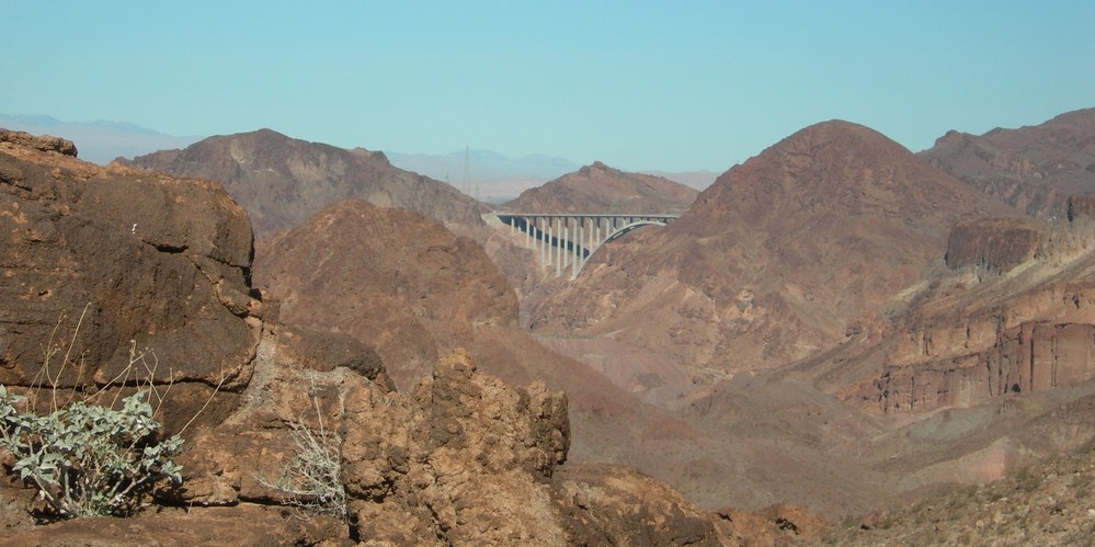
On January 17th, 2011 some good friends and I went on a hike to the Liberty Bell Arch on the Arizona side of the Colorado River below Hoover Dam. The 2.5 mile hike route provided several views of the new O’Callaghan – Tillman Memorial Bridge located upstream about 3 – miles.
 The Bridge was also visible from the Liberty Bell Arch. We could only get 1/2 the bridge into the photo due to the angle of the river and we would have to be flying out over the river to get the full bridge in view.
This was my first crossing of the bridge since its opening in November 2010. Speed was 55 MPH and we just zipped across at 8:00 a.m. in the morning. You can not see the Colorado River or Hoover Dam while driving across the dam, so do not try. On the Nevada side of the river you have to take the Hoover Dam Access road(the old road) down to either the new visitor parking at the bridge to walk out on the bridge on the Hoover Dam side only; or drive on down to parking at the dam in order to get photos of the new bridge and visit the dam. There are no bike lanes on the bridge for riding across, but you can walk across on the walkway.
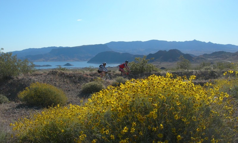
To ride a bike to the Hoover Dam or Bridge viewing one can access via the Historic Railroad Trail at Alan Bible Visitor Center located approximately 4.0 miles west of Hoover Dam. This ride will provide great views of Lake Mead while passing through five large railroad tunnels on the way out to the dam. The trail is wide and the tread is native material with a very gentle grade until the very end. The last 1/4-mile drops down to an access point to the Hoover Dam visitor center where you can either walk the bike down a Switchback walkway or park and lock at the top. The Bureau of Reclamation has not yet made a direct connection from the Historic Railroad Trail to the Bridge viewing area, so be careful crossing roads.
LIBERTY BELL ARCH TRAIL: Link to article by Deborah Wall in The View – http://www.viewnews.com/2011/VIEW-Jan-11-Tue-2011/CentennialHills/41270190.html  if you clip this article and follow it, you will find yourself at the Liberty Bell Arch on the Colorado River.
A Destination Trail
After posing the question on Facebook about whether the users thought the River Mountains Loop Trail was a “Destination Trail,” I have to concur that it is. My brief research doesn’t really define what a destination trail is so I’m setting out to determine what makes this a destination trail. So I went to Wikipedia and started with:
A Destination Hotel is a hotel whose location and amenities make the hotel itself a destination for tourists, rather than merely a convenient place to stay while traveling through or visiting the area for other reasons.”
So if I do a little word-smithing we get:
A Destination Trail is a trail whose location and amenities make the trail itself a destination for tourists.”
So in other words the trail itself is the primary reason for the visit or trip, and the amenities (the hotel, the restaurants, etc.) add to the reason to visit the trail. I have also heard the phase “World Class Trail.” Let’s explore some of the reasons why this trail would be considered a Destination Trail.
- It’s a 34-mile paved loop trail, non-motorized, and 12-foot wide.  Suitable for street bikes, mountain bikes, jogging, running, hiking, walking, roller-blades, 5-k’s, 10-k’s, marathons and triathlon and even horse-back riding.
- It’s both a rural and urban trail connecting the communities of Henderson, NV. and  Boulder City, NV. to Lake Mead National Recreation Area and Hoover Dam via connecting Historic Railroad Trail.
- It circles/loops around the River Mountains which is full of wildlife year round and wildflowers in the spring, offers unobstructed views of Lake Mead, numerous mountain ranges, and of course the one and only Las Vegas.
- Speaking of wildlife the River Mountains is home to one of the largest and most productive Desert Big Horn Sheep populations in the Western USA.
- The trail is also a trip into and through history of Southern Nevada. Kiosks and waysides along the trail system tell the story.
- Speaking of amenities one will find five (5) different hotels and resorts connecting to the trail system, something for everyone’s taste.
- The trail also connects you to other destinations along the way such as Historic Downtown Boulder City; Lake Las Vegas Resorts; Hoover Dam; Wetlands Park Trail system; and multiple trail connections into the Henderson Community and  Las Vegas.
Wow. I just sold myself on a trip to visit the River Mountains Loop Trail and I only touched on some of the big reasons. I like the scenery, the views, the peace and quiet, the huge wide open spaces and the solitude one experiences along the trail. There is something for everyone’s trail needs.
Where else in the world can you jump on a bike and ride on a trail system and see two of the world’s engineering marvels at the same time? I’m referring to Hoover Dam and the Tillman – O’Callaghan Bridge.
Historic Railroad Trail featured in Rails to Trails Magizine
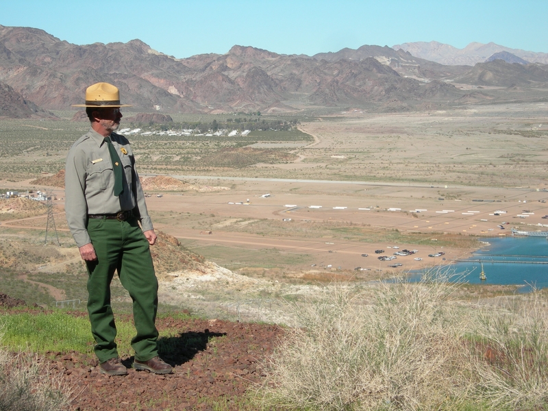
Nov. 20, 20009 – The winter 2009 edition of Rails to Trails is out and it feature The Historic Railroad Trail At Lake Mead on the cover, plus a six page article and photos within. The photo shoot took place back in the spring which several of us from the River Mountains Trail Partnership participated in. Only Jim Holland’s photo made it into the article. Jim is the Lake Mead Park Planner and was deeply involved in the completion of the Historic Railroad Trail. I also interviewed twice with Ben Spillman, but of course was not quoted in the article either, such is the life of one who works behind the scenes.Â
Link to article: http://www.railstotrails.org/news/magazine/index.html  Â
 The article is well written and certainly covers the many user groups who visit the trail on an annual basis. The history of how the trail was built makes another story which is covered elsewhere in this BLOG site.  Look under “History” category.
I have a few behind the scenes photos of part of the official photo shoot. You will also find detailed information, photos, and maps on both the Historic Railroad Trail and the River Mountains Loop Trail at www.traillink.com
See Gallery below.
- Jim Holland & Trish Tunnel #5 Spring 2009
Hoover Dam Connecting Trail – Historic Railroad Trail
Hoover Dam connector trail canyon wall 2004
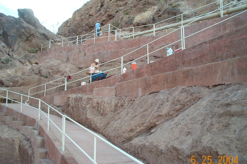
Nov. 6, 2009 -  I ran across these old photos of the building of the connecting trail from the Historic Railroad down to the Hoover Dam Visitor center parking garage. This was probably one of the most expensive trail segments due to the NEPA and historic nature of the area; plus it had severe construction challenges. We had to hang a trail on the side of a canyon wall.
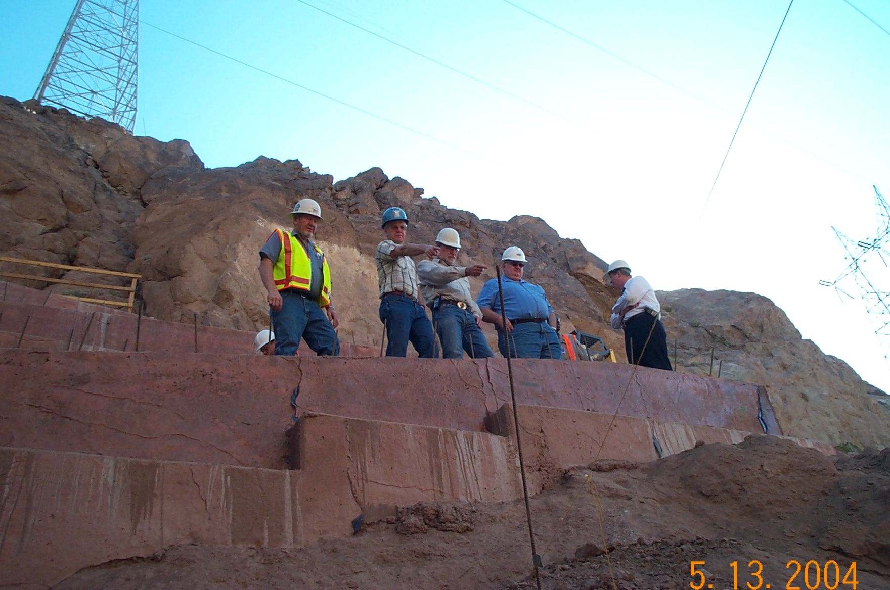
Hoover connector trail - contractor & trail partners 2004
 The River Mountains Trail Partnership was activily involved in the completion of the Historic Railroad Trail including the Hoover Dam connector as it would become a landmark and historic destination on the whole trail system.
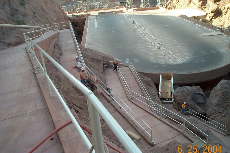
Hoover Dam connector trail switchbacks down canyon wall to garage...2004
The completion of the Historic Railroad Trail and the Hoover Dam connector trail were dedicated and open to the public in October 2007 with a bike ride from Boulder City to the Hoover Dam. The trail section from tunnel #5 to the dam is only open during daylight hours.Â
In the gallery photos below is one old B & W photo from Bureau of Reclamation public file photos showing the Hi-mix concrete plant with a steam locatmotive. This is the same location of the current Hoover Dam Connector Trail. If you look closely you’ll see the same large crack in the rock formation on the left.
Hoover Dam Connector Trail photo Gallery:
Â
Trail Alert – Historic Railroad Trail work finished Oct. 21, 2009
October 22, 2009 – Historic Railroad trail is now open again to Hoover Dam.  Reclamation has improved the area that crosses the Police access road. We have striped a cross walk, and paved from the exit of the switchyard to the top of the switchback trail down to the parking garage.
ADDITIONAL WORK PLANNED FOR 2010 – The Bureau of Reclamation Work planned for 2010:
- Â install 2 drinking fountains
- Install 1 vault toilet
- Install a shade shelter and table
- Install benches along trailÂ
- Correct  two dips to bring up to accessibility grade
- open up the back trail loop,
- and develop a trail map complete with lengths, elevations, GPS.
In my opinon these announced improvements will make this one of the best and most unique trail experiences in the Western States. The back loop mentioned is more of the actual rail bed used to build the dam, which has been off limits to the public for years. With completion of the bridge next year and these improvements the trail experience will just get better and better.
Â
OCTOBER 13th, 2009 -Starting tonight about sundown a contractor will be ripping out the Hoover Dam Police road to repave it.   Reclamation would appreciate it if NPS and River Mountains partnership ask people to be careful in the area where the Historic Railroad trail crosses the roadway to the POLICE substation.
The contractor will be paving the trail from the switchyard exit bollards to the top of the Zig Zag trail, painting a cross walk across the police roadway, and paving the short term drop off and pick up area.
The trail will still be open dawn to dusk as the contractor is working nights, dusk to dawn on the project. However, at times their will be some cones and tape to reroute the trail while they pave the trail areas. This is a 2 week project and should be completed by October 23, 2009.
Reclamation will provide you updates as they become available.
Â
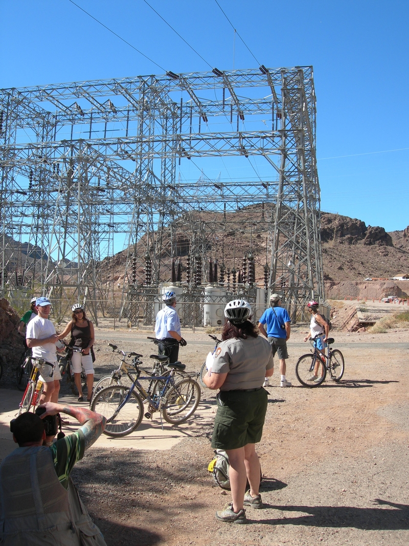
Hoover Switch & Police station work area 2009
(NOTE: This area is just before you enter the paved switch-backs down to the dam parking garage. Be safe and tell your friends.)
River Mountains Loop Trail now found on Traillink.com
October 6, 2009 – We can now be found on traillink.com a map and trail location service provided by Rails-to-Trails Conservancy. A good three and half miles of the RMLT are built on Historic Railroad bed within Lake Mead NRA. Also the RMLT links up with the official Historic Railroad Trail at the Alan Bible Visitor Center where a joint trail head is shared by both trails. By riding or hiking these two trail sections you can experience 7.5 miles of the old railroad grade used to build Hoover Dam.  So please look for us at www.Traillink.com  feel free to post comments and photos there.
