River Mountains Loop Trail

Facebook icon

  • Home
  • About
  • Trailheads and Maps
    • Trailheads in Boulder City
    • Trailheads in Henderson
    • Trailheads in Lake Mead NRA
  • History
    • Geology of the River Mountains
    • A -Desert Tortoise – Do’s & Dont’s
    • Keep It Clean
  • Blog
    • Recently on Facebook
  • Contact
    • Contact List

Hoover Dam Connecting Trail – Historic Railroad Trail


Hoover Dam trail up DCP 2004

Hoover Dam connector trail canyon wall 2004

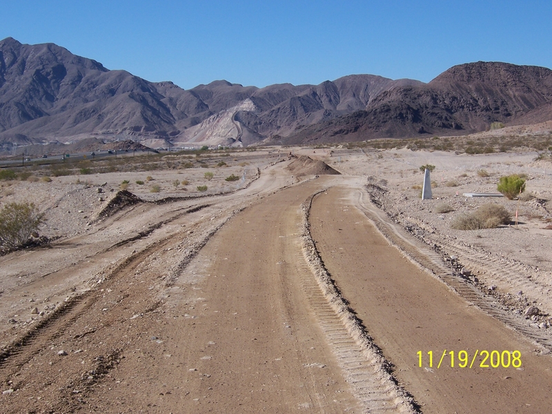
Nov. 6, 2009 -  I ran across these old photos of the building of the connecting trail from the Historic Railroad down to the Hoover Dam Visitor center parking garage.  This was probably one of the most expensive trail segments due to the NEPA and historic nature of the area; plus it had severe construction challenges. We had to hang a trail on the side of a canyon wall.

Historic rail trail switch backs dam 6

Hoover connector trail - contractor & trail partners 2004

 The River Mountains Trail Partnership was activily involved in the completion of the Historic Railroad Trail including the Hoover Dam connector as it would become a landmark and historic destination on the whole trail system.

Hoover Dam trail down DCP

Hoover Dam connector trail switchbacks down canyon wall to garage...2004

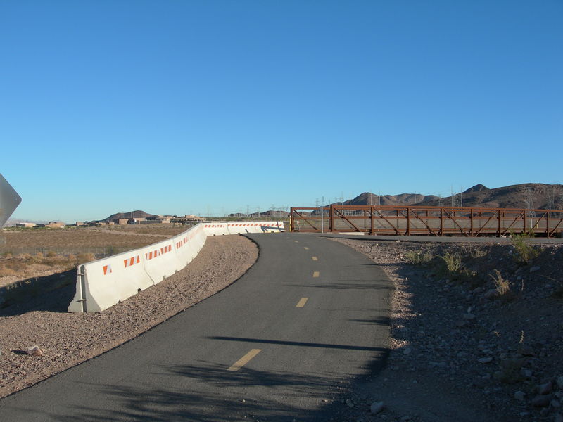
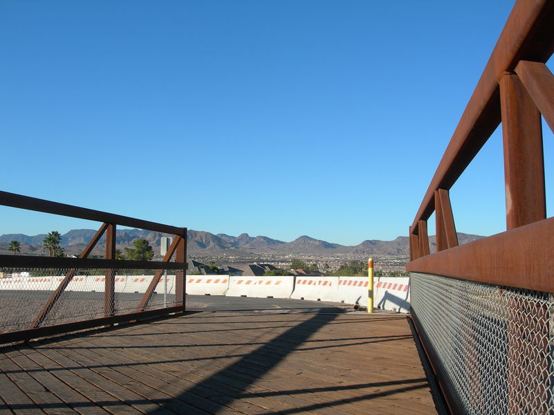
The completion of the Historic Railroad Trail and the Hoover Dam connector trail were dedicated and open to the public in October 2007 with a bike ride from Boulder City to the Hoover Dam. The trail section from tunnel #5 to the dam is only open during daylight hours. 

In the gallery photos below is one old B & W photo from Bureau of Reclamation public file photos showing the Hi-mix concrete plant with a steam locatmotive. This is the same location of the current Hoover Dam Connector Trail.  If you look closely you’ll see the same large crack in the rock formation on the left.

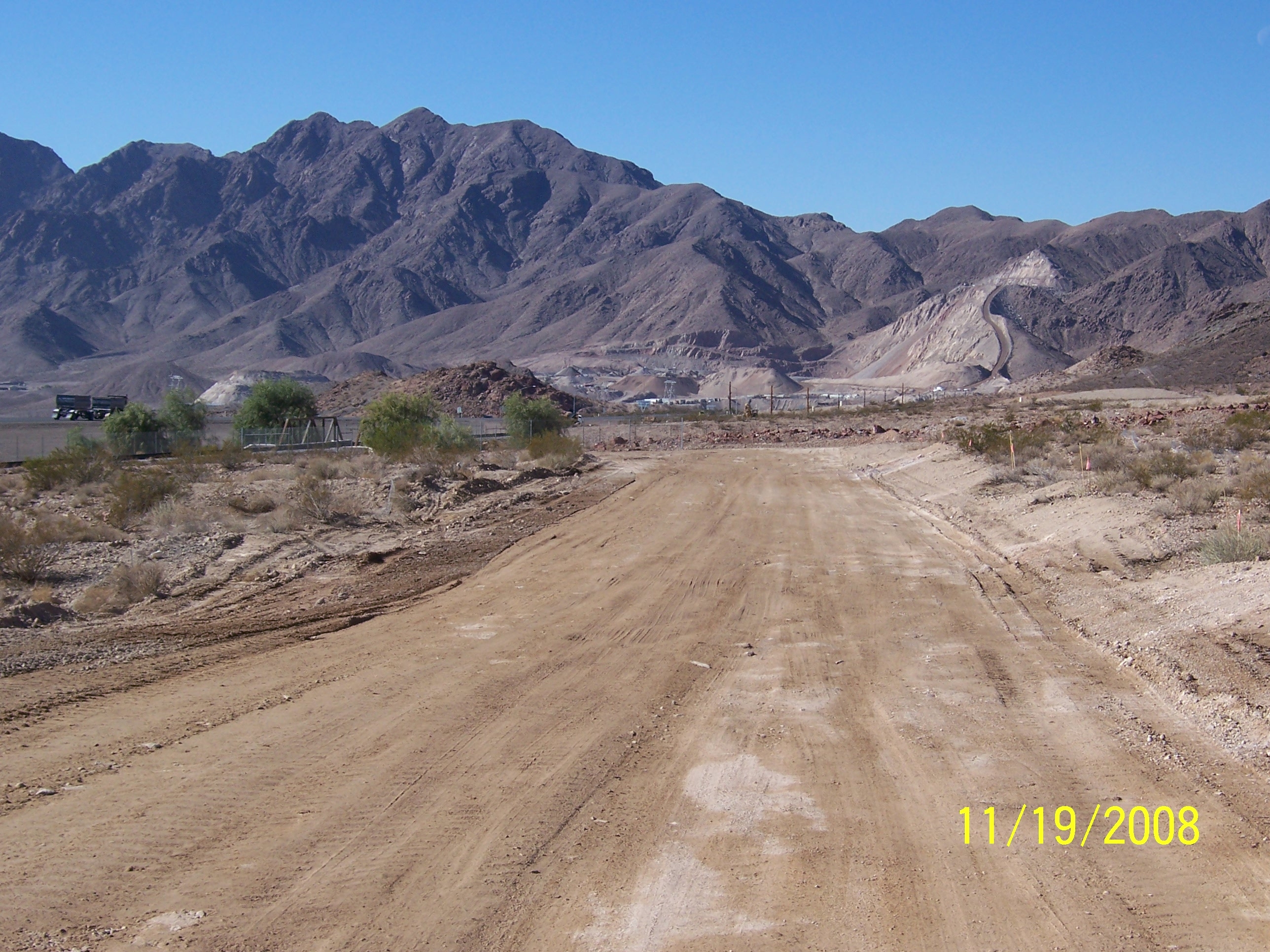
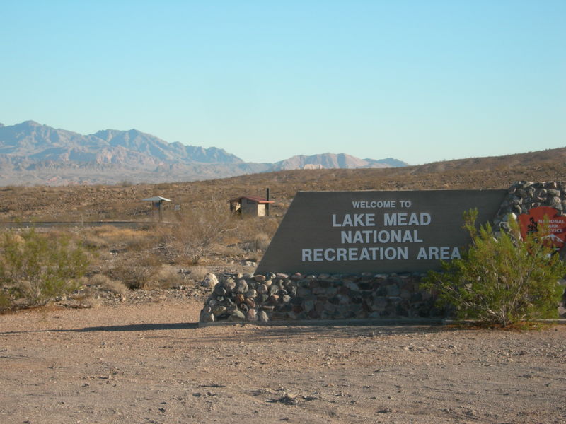
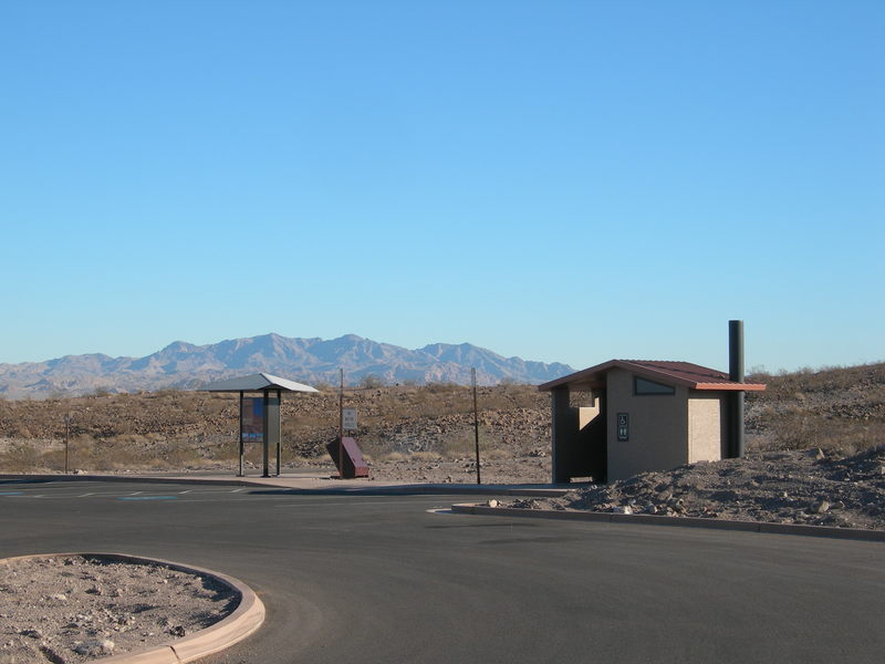
Hoover Dam Connector Trail photo Gallery:


Boulder City – Bridge Deck Poured 8/06/09; Completion to Railroad Pass nears…

August 19, 2009 – It’s not official, “BUT” the bridge is done and open for use.  I have heard reports that the new B.C. connection is getting lots of use.  We may have  to install traffic signals?   Just kidding. 


B.C. Bridge concrete curing 8-08-09

B.C. Bridge concrete curing 8-08-09


SAFETY NOTE:  Until the signs and stop lines are installed at the railroad crossing PLEASE stay back from the RR-tracks on weekends when the tourist train is passing. Ill try and get the hours of operation post here in the next few days.

AUGUST 6, 2009 – Bridge decking was poured early this morning (see photo below).  Please give it a few days to cure and respect the contractors closed signs.  Getting lots of feedback about riders riding the new paved sections to and from Boulder City.   

BOULDER CITY  AND THE RMLT PLANNING OCTOBER 17TH TRAIL OPENING CELEBRATION.  STAY TUNED FOR DETAILS!!!


rmlt #5 Bridge Decking poured 8-06-09

rmlt #5 Bridge Decking poured 8-06-09


July 28, 2009 – Bridge approaches paved. Bridge decking scheduled to be poured this week; then needs a week to cure.  So look for  bridge opening August 10th more or less. 

Also contractor working on segments 3 & 4 paved portions of segment #4 around the Vet’s home.  The trail is trekking east day by day toward a late summer completion. 

 July 23, 2009 – More progress to report as paving took place earlier this week on the remain portions of Segment #5 from Railroad Pass Hotel & Casino to the Pedestrian Bridge.  The bridge is not complete, no decking, so do not plan to ride just yet.


RMLT #5 paved to Railroad  Pass Casino  72309

RMLT #5 paved to Railroad Pass Casino 72309


 July 16, 2009 – More retaining wall work photos. this one is where the River Mountains Loop Trail will cross the historic railroad .  Work progresses daily and everyone is waiting for the pavement lay down day and completion. 


RMLT # 5 Retaining wall ar RR Tracks crossing 71409

RMLT # 5 Retaining wall ar RR Tracks crossing 71409


Retaining Wall at Railroad crossing 71409

Retaining Wall at Railroad crossing 71409

June 29, 2009 – Retaining wall work above the highway and below the railroad tracks is tedious work. Here is photo provided by Gary Zupanic, B.c. Engineer of the work being completed.


 June 24th, 2009 – Bridge decking has not been poured yet.  Trail construction continues toward Railroad Pass Hotel, one more retaining wall and drainage culvert needs to be placed, then final grading, type two gravel base, and paving in about three weeks. Could be available by mid-July for riding???
Retaining wall work near Railroad Pass 62909

Retaining wall work near Railroad Pass 62909


Segments 3 & 4 have been given the green light to start and grading started Monday this week. We’re estimated late September/early October for completion.  We are so hopeful that we have scheduled a trail ribbon cutting ceremony for Oct 17, 2009. Stay tuned for details.

May 28th, 2009 – Bridge now in place. Due to traffic considerations on private Cascata Drive, bridge was set in place over night May 27 -28, 2009. Bridge is 163 -ft long. This is truly a milestone in the completion of the River Mountians Loop Trail. The paved section from the Bridge to Railroad Pass Hotel is still several weeks from completion. 

RMLT Bridge #5 installed Zupanic photo 52809

RMLT Bridge #5 installed Zupanic photo 52809

Bridge Facts:  It is 163-ft. long & 14-ft wide between trusses

  • Built by Contech Bridge Solutions (formerly Continental Bridge) 
  • Contractors bid amount for bridge $240,000
  • Concrete Bridge abutments cost $58,000
  • Bridge is a free span steel, model H1-SQ, fabricated from self-weathering atmospheric corrosion resistant steel
  • Bridge will have a lightweight concrete deck

May 27th, 2009 – BRIDGE READY TO BE PLACED TODAY. CHECK IT OUT…..HOPE TO HAVE PHOTOS POSTED BY DAYS END. 

Photos by Jim Holland

 Ped. Bridge ready to set 52709

 April 13th, 2009 – The long awaited Boulder City Trail bridge for segment #5 has arrived on the job site. The footings are still being placed, but the bridge is here. The bridge is required to span the gap across the private Cascata Golf course road and will be placed just north of the railroad bridge .  No date has been set for the placement, but you’ll see and hear about it here. 
 
RMLT #5 Bridge 150-ft arrives

RMLT #5 Bridge 150-ft arrives

April 20th, 2009 – The other great news regarding Boulder City’s portion of the RMLT is they have advertised for bids on trail segments 3 & 4 with bids due on May 7th, 2009. This means we/they could be under construction on their last trail segments by mid-June or  at least by July 1st, 2009 .
We are slowly closing the loop on a 12+ year trail project which will connect and link the cities of Southern Nevada to Lake Mead National Recreation Area and Hoover Dam.  The River Mountains Loop Trail will become a national destination trail system. 🙂
April 29th, 2009 – RMLT field trip to Segment #5 bridge abuttments. Nice walk with great views of Eldorado Valley,  River Mountains and wild flowers along the way.
SEg. #5 bridge abuttment 42909

SEg. #5 bridge abuttment 42909Â Â Â 163-ft. bridge May 28,2009 Holland photo


Gallery of photos:

RMLT #5 Bridge Lift zupanic photo 52709

RMLT #5 Bridge Lift zupanic photo 52709

RMLT #5 paved to Railroad Pass Casino 72309 Garys photo

RMLT #5 paved to Railroad Pass Casino 72309 Garys photo


RMLT#5 pavement crosses Railroad wst of bridge 72309

RMLT#5 pavement crosses Railroad wst of bridge 72309

Three Kids Mine site along Trail

Jan.29th, 2009   Three Kids Mine is part of Southern Nevada’s mining history. It is locate near Lake Las Vegas at trail mile marker 9.0 to 10.5.  There are several deep open pit mines where manganese ore was mined then processed in a mill on site. Mining was activity from around 1917 until the plant was closed in 1961. The site has sat idle for 48 years. It was used in two movies over the years and has been an eyesore for most of the 48-yrs.  Plans are now afoot to clean up the area and turn it into a master planned development of some 1250+ acres.  The development is currently known as “Lakemoor Canyons”.  The project is in the planning, review, approval stage and will require many permits. The actual clean up of the site is about 12 months out if all goes well.

Three kids mine unger/RJ photo

Three kids Mine Unger/RJ photo

History:

The following is an except out of the Review Journal dated May 12, 2005. The article is written by A.D. Hopkins and talks about the Merle Frehner family history….
During World War I the Three Kids Mine, the remains of which are visible southeast of Sunrise Mountain, was producing manganese ore. Harry (Frehner) hauled the ore to the Las Vegas rail yards behind a 10-horse team pulling three heavy-duty freight wagons and a feed cart, hooked one behind the other. “When reaching the east end of Fremont Street, Harry drove straight up the center to the depot, then south to an unloading platform. Crowds of people would line the sidewalks to watch the long outfit go up the street.”  This would have been between 1914 and 1918.


Three Kids mine site today RJ Photo 11-08-09

The following notes and statements come from an article printed in the “MINING CONGRESS JOURNAL dated October 1944….”The three Kids Mine near Las Vegas, owned by the Manganese Ore Company, wholly-owned subsidiary of The M.A. Hanna Company, has proved to be the largest open pit deposit of good grade manganese ore available in America, Vice President M.C. Lake of the ore company said in a recent statement.”

The millling plant next to the mine was owned and operated by the Defense Plant Corporation and as of this writing had produced several thousand tons of high grade manganese nodules. The plant had not yet reached full production according to the article.

Other items of interest from the article are: 1.) Part of the process involved leaching a processing pulp …”in a series of seven thickeners, the first two of which are acid-proof construction and 250 feet in diameter, thus making them the largest acid-proof thickeners ever constructed.” 2.)The “manganese sulphate salt which is roasted in a rotary kiln 360-ft. long and 11ft 3 inches in diameter, to yield a calcine of Manganese oxide and sulpher dioxide gas.”
The article from the Mining Congress Journal also had multiple photos of operations at the mine….Steam shovel loading dump trucks;beginning of the open pit mine operation; Drilling being done by churn drills and rock drills; mining pit with stock piles of ore and mill.

Movies:
Do you know the names of the two Hollywood Movie productions that took place at Three Kids Mine????

The first one I’m still researching. It was filmed after 1961 and involved the blowing up of the mill/plant during filming. I’m told it was in the early 1970’s? Does anyone know…please help me out.

The second film/movie was released February 5, 1987. It was shot entirely on location in southern Nevada. A major battle scene and shoot out occured at the Three Kids Mine site. The name of the movie is “CHERRY 2000” – a 1987 science fiction cult film starring Melanie Griffith and David Andrews. My personal review of movie would make it a “B” movie, acting was not so hot, plot was ?; but the scenery of Southern Nevada was great. The Three Kids Mine shots show some of the remaining structures from the mining days. The big 250-ft concrete thickeners look like alien structures in the film. The movie pops up every now and again on HBO, don’t waste your money renting a DVD.


Cherry 2000 Movie Poster 1987

Cherry 2000 Movie Poster 1987

The River Mountains Loop Trail:

The trail will front the Three Kids Mine site along the south side of Lake Mead Parkway from the tunnel underpass east to the commercial buildings. At this location the trail will cross to the north side via a tunnel and then follow the BMI waterline right-of-way east for about one mile. The trail will pass under Lake Mead Parkway at the far eastern edge of the Lake moor Canyons development.  This trail alignment is currently under design. We expect completion by end of 2009 2010.

THREE KIDS MINE PHOTO GALLERY:


Loop Trail project brings biologist to town to help protect desert tortoises

Great Article in todays Boulder city View about trail construction of Segment #5 of the River Mountians Loop Trail.  Good discussion about desert tortoises.  This was an unbudgeted expense for the construction, but necessary.

follow this link to the entire article:

http://www.viewnews.com/2008/VIEW-Dec-23-Tue 2008/BoulderCity/25843818.html

Detention Basin Construction Impacts Trail

January 25, 2010 – This last Saturday my wife and I went hiking MM 6.5 to 4.5 along the trail. This project has a minor detour in the trail to watch for.  It appears that the project is nearing the completion phases.  A huge berm/dam has been built above the trail not far from the Harve St. entry.  It also appears that this project cuts off any vehicle access into the back country that locals have been using to riding on for the last 50+ years.  Besides the huge basin; the project has built small dams/berms in the mouth of almost every canyon or drainage coming out of the River Mountains all the way south to SNWA Water Treatment Plant and then connected them all with a concrete lined channel most of which is currently fenced.  Below is a photo of the channel taken just north of SNWA Plant looking north.


River Mountains flood channel looking north 1-23-10

May 5th -2009 – It was noted during a safety tour of trail in Henderson that the tortiose fencing discussed below has been moved back from the trail where it is no long a safety issue.  The truck crossing now has stop signs up and there are lots of trucks hauling gravel on an hourly basis so beware.

March 2, 2009 – Over the last week or so fencing has gone up along the trail for about 100-yards. BEWARE this could be a safety issue. We are working through the City and the contractor to be sure all safety measures are in place. The tortiose fencing has also blocked off an ATV off-road vehicle path to the foothills which has been pushing them on to the trail. Please notify HPD if you see this happening at 267-5000(option #1 – give description and direction).

Tortoise fence edge of trail 2/09

Tortoise fence edge of trail 2/09

January 20th, 2009 – A brief update. At last weeks Planning Commission meeting the variance was approved to allow the rock crushing operation to move ahead. Commissioners found it less of an impact to crush on site than remove material through the neighborhoods.  Rock crushing activity to start Feb. and last up to 18 months.  My hope is they are good neighbors for the trail and its users. Lets keep our eyes open…

December 10th, 2008 – Starting week of 12/15/08 construction equipment will start arriving and setting up for the construction of Henderson’s Northeast C-1 Detention Basin located just east of the trail in the foothills of the River Mountains. Construction activity will be near mile marker 6.5 and 7.0.   The contruction period is for 15 months or until about March 2010.  “So beware of equipment crossing the trail and rocks on the trail”

The contractor is “Capriati Construction Corp.”  Along with the detention basin there will be a rock crusher on site processing aggregate for the work. Per maps available from the City a channel will run along the foothills east of the trail to collect run-off from the mountains sending it to the detention basin; from there an outfall will go under the trail in undergo round pipes to the C-1 channel following the Ithica St. alignment.  Ithica St. is supposed to be the ingress/egress access for this project.

The project manager for the City Public Works assures us that they will keep the area watered down for dust and will clear the trail daily of any rocks.  If problems develop or the trail deteriorates please let us know by calling either 267-4050 or 365-2191.

ne-detention-basin-c-1-channel-dec-2008

Detention basin Map 2008

Trail Entry from a road – Good example by NPS

Photo says it all, good signs, gate, bollards, and rock

Photo says it all, good signs, gate, bollards, and rock

Boulder City Connection – construction status

  The first mile from east to west is now paved and striped see photo below.  The east bridge footing is also underway as shown in following photo. This is the good news.  The bad news is construction is behind schedule due to some additional soil tests and borings required by NDOT in the pass area. We are now looking at a possible June/July opening date. Stay tuned.

#5 Paved & Striped looking west

#5 Paved & Striped looking west

March 20, 2009 – Bridge footings being dug & trail striping down on east end.

rmlt west bridge footing

rmlt East bridge footing


Feb. 24, 2009 – Paving to Cascata Rd. done. This segment is not open to the public, but hey check it out. Bridge has been ordered and is about six weeks out.  Rough grading from Cascata west to Railroad Pass has been done. Work currently on hold until retaining wall work in the pass area can be completed, test boring is now complete.

RMLT 5 paved Bootleg trail head veterans home

RMLT 5 paved Bootleg trail head veterans home


Feb. 12, 2009 – Great news today…Paving started Wednesday on the trail from Cascata Rd. back to the Veterans home.  Grading continues toward railroad pass.

Photo of asphalt lay down on Feb. 11, 2009:

Segmetn #5 paving 2/11/09

Segmetn #5 paving 2/11/09

Jan. 20, 2009 – Grading and drainage work is now approaching 93/95 where you can see the activity from the road. The following photos were taken last week showing work between the highway and the railroad tracks.  This is where the construction gets tricky.

New photos of work here:

Construction pushes west to RR Pass Jan. 09

Construction pushes west to RR Pass Jan. 09

Nov. 20, 2008 – Construction work has started near the B.C. veterans homes  and is moving west along the SNWA water line alignment about the railroad tracks. Work started in September with 240 day construction contract.  The east portion of the project is fairly easy and straight forward, but gets more challengingmoving west. At the Cascada private road the contractor has ordered and has to place 150-foot pedestrian bridge over the roadway. Contuning west the trail turns down and crosses the railroad tracks then turns west again following an ever narrowing r.o.w. between uS 93/95 and the railroad.  The trail curves around to the north and encouters multiple dips or drainage issues which require extensive rock retaining wall work in order to lift the trail up and allow drainage to continue underneath. The final leg of the section then drops down into the Railroad Pass Hotel trail head already existing from previously completed portions of the River Mountains Loop Trail by the City of Henderson. 

I have included a few photos of current construction progress for your viewing pleasure.  As you can see there will be fantastic views of the mountains and Eldorado Valley below.

RMLT #5 Boulder City going west

RMLT #5 Boulder City going west


The day the ribbon is cut for this trail segment opening will be a grand day in trail development for Southern Nevada.

Boulder city #5 RMLT west

Boulder city #5 RMLT west

RMLT #5 West Bridge footing

RMLT #5 West Bridge footing

K-Rails installed along the trail….Why?

rmlt-k-rail-equestrain-bridge-111808

Equestrain Bridge K-rail installation

K-Rails installed for safety – This segment of the River Mountains Loop Trail was and is being abused by illegal ATV & Motorcycle activity. Signs disappeared faster than the City could install them and enforcement was not working. Trail users were at risk from jumping of the bridge embankments.  I see this as a short term fix, while better solutions are found. 

In the future more informative signs will be installed along this trail segment along with regular enforcement and it is my hope the K-rails can be replaced with less intrusive measures…ie. large desert rocks, post & cable along with native habitat restoration.

The City of Henderson and B.O.R. along with RMLT members are reviewing other areas that need K-rail placement in order to bring safety to the trail from illegal use.  The trail is being used more and more by local families expecting a safe outing; plus it has become a tourist attraction for out of town visitors looking to recreate off the strip. 

rmlt-k-rail-bridge-equestrain-11108

RMLT K-rails installation - User safety

NEW Trailhead…With Out a name?

View of Trailhead Lake Mead Pkwy NPS

New trailhead Lake Mead Pkwy NPS 2008

Oct. 27th 2008 – Hey all RMLT trail users.  We have a brand new trail head open and being used without a name? How did that happen? We are looking for a few good names which would locate and identify the trailhead, or not. The trail head is located off Lake Mead Parkway or maybe its Lake Shore Drive within Lake Mead Recreation Area – NPS. It’s paved, has a restroom, has a kiosk, and equestrian parking, etc. it just doesn’t have a name yet.  We’ve had several ideas within the advisory council, but none have stuck just yet. Here are several being kicked around:

  • Entry Station Trail head 🙁
  • Mountain View Trail head – you can see lots of mountains from this site. 🙂
  • Lake Mead Trail Head – but very trail in Lake Mead has a Lake Mead trailhead. 🙁
  • Lakeview Trail head – can’t see the lake from here anymore.
  • others….

Give us your suggestions……..


rmlt-lake-mead-new-trailhead-11808

New Trail Head Lake Mead Pkwy -NPS 2008

Magic Tree by Paul Grube Nov. 2008

Saddle Island Rd. Tunnel Open

CLOSED SEGMENT RE-OPENS SEPT 26TH 🙂

I NOW HAVE PHOTOS OF NEW TUNNEL OPENING SEE BELOW.


Boulder City, Nev. – From Aug. 18 through Sep. 18, 2008, a small segment of
the River Mountains Loop Trail (RMLT) will close for improvements to
accommodate construction activities associated with the Southern Nevada
Water Authority’s (SNWA) third intake project. The trail segment to be
closed is the section about one-half mile.  It is the section from the
former site of Lake Mead Cruises (just north of Boulder Harbor on Lakeshore
Road), up to the Nevada Department of Wildlife Fish Hatchery.

Improvements will include realignment of the trail to incorporate a
culvert, routing RMLT traffic below Saddle Cove Road.  The culvert will be
put in place to protect RMLT users from construction traffic related to the
SNWA Third Intake project. The small section of the trail will remain
closed for about four weeks.  The rest of the RMLT will not be affected by
this work.
National Park Service
U.S. Department of the Interior
LAKE MEAD NATIONAL RECREATION AREA
News Release
For Immediate Release: August 8, 2008   Release No.: 39-08
Contact: Andrew S. Muñoz, 702-293-8691

After being closed almost one month SNWA/NPS re-opened this segment after placing a concrete tunnel under Saddle Island Rd. This work is complete just in time for the high use period going into Fall and winter months. Thanks NPS/SNWA for a timely fix…!

Saddle island Rd. Tunnel-Holland Photo

Saddle island Rd. Tunnel-Holland Photo

Next Page »

Recent Blog Posts

Dogs on the Trail

Las Vegas Hiking Trail Featured in Article

Las Vegas Hiking Trail Featured in Article

Pacifica trail head Boulder City on the new trail website.

New Trail Website

Be Sure to Visit

Latest Posts on Facebook

Comments Box SVG iconsUsed for the like, share, comment, and reaction icons
River Mountains Loop Trail
1 month ago
River Mountains Loop Trail

If they can do it, we can do it. The Red Rock Legacy Trail is next! ... See MoreSee Less

View on Facebook
· Share
Share on Facebook Share on Twitter Share on Linked In Share by Email
View Comments
  • Likes: 63
  • Shares: 3
  • Comments: 9

9 CommentsComment on Facebook

Congratulations!

I looked up the new paths for Red Rock so look forward to using them.

One of the BEST bike trails in the USA!!!!!!!!!!!!!!!!!!!!!!

Love it!

Elizabeth Keegans

I can’t believe its been 25 years John Holman!

looks so awesome, look forward to an organized inaugural group ride

John Holman and Ron Floth are rockstars!

Are they ever going to fill the horrible cracks on RMLT??

View more comments

River Mountains Loop Trail
1 month ago
River Mountains Loop Trail
Thank you for enjoying the RMLT Celebration - Picnic/Potluck with us today!

Thank you for enjoying the RMLT Celebration - Picnic/Potluck with us today! ... See MoreSee Less

View on Facebook
· Share
Share on Facebook Share on Twitter Share on Linked In Share by Email
View Comments
  • Likes: 51
  • Shares: 0
  • Comments: 1

1 CommentComment on Facebook

Sorry I missed your get together I rode the American Lung Association ride yesterday, I what to touch base with your group about You need to take a look at mile marker 11.5 to 13.5 large cracks in the road. And thank your River Mountain Loop

River Mountains Loop Trail
1 month ago
River Mountains Loop Trail

Come join us in celebrating the 25th year of the River Mountains Loop Trail! We will be gathering at lower Equestrian Park from 11:00-1:00pm on Saturday, November 4th for a community pot-luck. Bring your chair and something to share. 🚶🏇🚴‍♀️ ... See MoreSee Less

This content isn't available right now

When this happens, it's usually because the owner only shared it with a small group of people, changed who can see it or it's been deleted.
View on Facebook
· Share
Share on Facebook Share on Twitter Share on Linked In Share by Email
View Comments
  • Likes: 32
  • Shares: 0
  • Comments: 6

6 CommentsComment on Facebook

Please join us tomorrow for a lovely picnic at Lower Equestrian Park. We will have a few activities for the kids and distribute information about the RMLT.

Choose your own adventure and enjoy the trail from 8:00-11:00 am. Let us know what your favorite part of the RMLT is. What do you enjoy most about the trail?

Sorry to be negative but I don't know how we can celebrate something that is not functioning properly. Tires are flattening from the large gaps. It is throughout the entire RMT with the exception of the new part of the RMT on the Boulder City. This was once an awesome trail.

In 2003 I remember riding the three sisters from the dirt lot on Lake Mead to the end which was around 3 miles.

Carla Jo Panico Darcy Walker Fitch Mary Fitch

The large CRACKS in the road 

View more comments

Load more

View Full-Sized