River Mountains Loop Trail

Facebook icon

  • Home
  • About
  • Trailheads and Maps
    • Trailheads in Boulder City
    • Trailheads in Henderson
    • Trailheads in Lake Mead NRA
  • History
    • Geology of the River Mountains
    • A -Desert Tortoise – Do’s & Dont’s
    • Keep It Clean
  • Blog
    • Recently on Facebook
  • Contact
    • Contact List
  • Donate

Nevada Silverman Triathlon Receives Tourism Impact Award

January 26, 2010 -  The 11th Annual Henderson Economic Development Awards held on January 21st at the Ritz-Carlton awarded the Silverman Triathlon the Outstanding Special Event Award for Tourism Impact in 2009.  The following is an excerpt from the presentation and as published “In Business – CRE Special Supplement.”

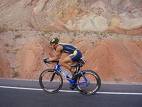
Silverman Triathlon Bike Rider

Every November for the past five years, the Nevada Silverman Triathlon brings athletes from all over the world to experience the City of Henderson from all different views, whether it is in the water, on a bike or on foot.

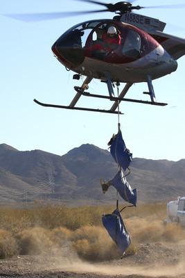
Silverman, a race organized by Frank Lowery of Lowery’s Multisport, has been branded the toughest course in North America by six-time Hawaii Ironman Champion Dave Scott.  The full-distance triathlon features a 2.4-mile swim in Lake Mead, a 112-mile bike ride and 26.2-mile run that boasts a 2,000 foot elevation gain.

In just a short time, the Nevada Silverman has become an international phenomenon.  This year, nearly 1,000 athletes participated in the grueling competition, representing all 50 states and 15 different countries.  Additionally, race organizers partnered with Operation Rebound and the Challenged Athletes Foundation (CAF) for the Operation Rebound Silverman Half Relay for the second year in a row.

The race allowed participants to form relay teams while supporting the men and women of the armed forces.  Some of the teams had the opportunity to race with an injured veteran of Operation Rebound, an organisation that supports disabled veterans.

Silverman attracted more than 10,000 spectators who not only enjoyed the race, but also the newly enhanced free health and wellness expo.

Nevada Silverman provides nearly $4 million in non-gaming economic impact to the City of Henderson.  Lowery has made Nevada Silverman a world-class race, allowing Henderson the opportunity to be the host location for the International Triathlon Union (ITU) World Championships in 2011.

 …………………………..

Frank told me the 2011 ITU event could attract 5,000 -6,000 athletes and over 30,000 spectators.  Economic impact to the city could triple that of 2009.  This event will need full Henderson Community Support.  ARE WE UP TO THE TASK?

Our hat is off to Frank and entire crew for a job well done.  The 112-mile bike course uses about 7-miles of the River Mountains Loop Trail through East Henderson and the Trail Partnership has sponsored the Bike Course Aid Station #10 for five years.,,,rmltman

Discovery Trail – History, Wildlife, Forces of Nature, Educational Tool


DISCOVERY TRAIL –  Yes, I believe the River Mountains Loop Trail is a discovery trail.  It is a great place for families to discover the desert world around them.  Young kids need a chance to explore and discover the world around them.  This is free for the taking sort of speaking.  At the various trail heads history or nature is intrepreted  for the user.  Along the trail waysides are being designed an installed telling about the history, wildlife, plants or some force of nature.  Plus there is the experience of discovering nature for yourself right there on the trail.  I tell many of my friends and hiking buddies that if they really want to see the world around them, then “Take a Hike” in it. 

Trails are all about discovery….what is around the next bend?…over the next hill? under the next tree or bush?  what is that old structure over there?…where do those power lines come from….where are they going?…what type of cacti?…bird, rabbit, snake, bug, lizard, rock, bush, etc? is that.  Do animals really live in the desert?  What types?

If one does a little reading and research before heading out on the trail you will be amazed at the local history right here in your back yard.  One of the goals of the River Mountains Trail Partnership is to help all trail users discover what the River Mountains has to teach us.   Take a little time read some of the BLOG categories and discover.  I have been at this about 18 months and have only discovered the tip of the iceberg.

Many of you ride the trail on bikes for recreation and exercise, but you are missing the discovery.  It is my personal goal over the next year to walk/hike every mile of the trail and personally discover all it has to offer.  How about you?

Here are just a few things along the trail to be Discovered and in no particular order:  HOOVER DAM…SADDLE ISLAND…FISH HATCHERY…RED MOUNTAIN…ALUNITE MINE…RAILROAD PASS…BOOTLEG CANYON…FLOOD CHANNELS… POWER LINES…GOLD MINES….THREE KIDS MINE…MOVIE FILMED HERE…MAGIC TREE…BMI WATER LINE…WATER RECLAMATION…COYOTES…BIG HORN SHEEP…BEAVER TAIL CACTUS…CRESOTE BUSH…TEXAS ACRES…SIXES COMPANY…HISTORIC RAILROAD…DESERT TORTOISE…MANGANESE MINING…AND SO ON.

Three Kids Manganese Mine

Three kids mine unfger/RJ photo

Three kids mine unfger/RJ photo

Manganese mine -  In the late 18th and early 19th centuries, manganese, an important metal needed to strengthen steel, was supplied to Untied States manufacturers mostly by foreign mines.  With the onset of World War I, these sources of manganese were cut-off, and an intense search for domestic sources was undertaken.  In Nevada, this prospecting effort led to the discovery of the Three Kids manganese deposit in 1917.  This mine provided most of Nevada’s manganese production during the last two years of WWI and operated intermittently until 1961.  This is the largest manganese mine in Nevada and, during the 44 years of operation, more than 2,225,000 tons of ore ranging from 15 percent to 40 percent manganese was mined and treated here.  Small amounts of lead, copper, silver and gold were also recovered by the mining operation.

The Three Kids Mine is on private land and access is strictly controlled. This and any other abandoned mines you might come across can be extremely dangerous. Resist any temptation you may have to explore these workings – ” Stay Out and stay alive!”

(Material provided by Nevada Bureau of Mines and Geology, Special Publication #16)

Three Kids Mine pit - Google Earth 1-20-10

Three Kids Mine pit – Google Earth 1-20-10

For more history and stories about Three Kids Mine see relate BLOG article including what movie was filmed on location here….rmltman…:)

Coyotes part of living in Southern Nevada by NDOW

January 19, 2010 – Here is the poop on Coyotes in Southern Nevada straight from the horses mouth, Nevada Department of Wildlife. This as you will see appeared in the Las Vegas Review Journal January 17th, 2010 under Outdoor Briefs.. It makes good reading and covers many of the items found on coyotes elsewhere in this BLOG.

________________________//

Jan. 17, 2010
Copyright © Las Vegas Review-Journal 
Coyotes part of living in Southern Nevada

Like many communities across the Southwest, those in the Las Vegas Valley have seen residential and commercial development reach into areas that were previously undeveloped. As it has elsewhere, that development has had a direct impact on numerous wildlife species and their habitats. While some species suffer from the impacts of urban development, the wily coyote continues to thrive.

From their original haunts, which extended from parts of north-central Mexico to southwestern Canada, coyotes have extended their range to nearly all of North America. Their range includes urban centers such as Los Angeles, Phoenix and Las Vegas.

“The amazing thing about coyotes is their ability to adapt and adjust to changes in their natural environment and to the challenges of living in an urban environment. They can sometimes be seen roaming areas located on the outskirts of the Las Vegas Valley and even farther into town,” said Doug Nielsen, conservation education supervisor for the Nevada Department of Wildlife.

A popular drawing card for Southern Nevada homebuyers are golf courses, water-based landscape design and life on the edge of natural surroundings. What homebuyers often fail to realize is that these qualities are just as attractive to a variety of wildlife, coyotes and other predators that are already living in the Mojave Desert.

“Oftentimes people buy homes on the desert’s edge so they can have a more natural experience, but they want to pick and choose what critters come to visit. It just doesn’t work that way,” Nielsen said. “Golf courses, landscaping with water features, and washes or other avenues that provide animals with direct access to and from open desert areas will sooner or later attract prey species such as squirrels, rabbits and birds. These species then become an attractant for coyotes and other predators looking for a meal.”

Though coyotes have been known to hunt and eat domestic pets, simply seeing one is not necessarily cause for alarm. Nor is it necessary to call NDOW. However, a call may be warranted anytime a coyote is showing threatening behavior toward people, especially children. The key to preventing possible conflicts with coyotes or other wildlife, according to NDOW, is to eliminate those things that attract them, beginning with possible food sources.

Never feed coyotes and encourage your neighbors not to feed them. Wild animals quickly become habituated to humans as a food source. Store pet food inside and feed pets inside if possible. If a pet must be fed outside, clean up any uneaten food.

Pets, especially small ones, should not be left outside unattended. This is especially true at dawn or dusk when coyotes are most active. If it is necessary to leave a small pet outside unattended, consider keeping it in a sturdy enclosure with a roof. It’s also a good idea to trim or remove any ground-level shrubs and branches that could provide coyotes with a hiding place.

Coyote attacks on humans are a rare occurrence, and when it does happen, the attacks are generally directed at young children.

Should you encounter a coyote, make loud noises, wave your hands or objects such as a stick or broom, or spray the coyote with water from a garden hose. Don’t turn away or run, because that may trigger the animal’s predator extinct, but don’t corner a coyote either. Give the animal room to escape.

More information about living with coyotes can be found online at www.ndow.org.

TRAIL RESOLUTIONS FOR 2010…

JANUARY 13, 2010 – Why can’t trails made Resolutions for the New Year too?  So here goes…The River Mountains Loop Trail Resolves to:

  1. Complete all new trail construction by year-end.
  2. Become Nevada’s newest National Recreation Trail designated by Interior Secretary.
  3. Increase trail user activity and support throughout the year.
  4. Increase interpretative waysides and Kiosks for the education and knowledge of my users
  5. Improve trail user safety
  6. Improve trail user enjoyment and outdoor experience.
  7. Share the outdoor experience with more kids and families
  8. Link up with new trails such as Burkholder Trail, Wetlands Trail, and others
  9. Encourage more trail users to become friends of the trail and volunteer
  10. Improve your quality of life if you will just come visit me….

Happy Trails to you in 2010….

McKeeversville, earliest settlement in the Boulder City area

Historic site…McKeeversville pre-dates Boulder City. It was where some of the first people settled prior to building of the dam and prior to the building of Boulder City.  The camp was also known as a squatters camp where the poorer famlies lived until better housing  came available. This area was also known as Government Survey Camp Number One during the actual building of Boulder City.  The lower portion of McKeeversville later became known as the Lakeview Subdivision which is active today.  The northern portion was abandoned and is listed as a ghost town in some records.  To many locals this was the other side of the tracks, as the railroad tracks ran between McKeeversville and the Boulder City township.  This area got its name from from a government cook who lived here with his family. 

McKeeversville Camp - Boulder City circa 1937-38

Today you can see remains of this Squatters Camp from the just completed River Mountains Loop Trail which passes along the edge of this camp.  Building foundations and walkways are still seen in the desert.  Old rusty cans, barrels, pipes and car parts in the area are relicts of the settlement.  Removal of these relicts is prohibited. Apparently McKeeversville ran up to the base of Red Mountain and into the area of Bootleg Canyon Park bike trails. 

Mckeeversville foundation and rock porch just off trail 1-0910

McKeeversville photo gallery: 

Mckeeversville foundation and rock porch just off trail 1-0910


Volcanoes in the River Mountains

Volcanoes in the River Mountains ? – This phrase will certainly get the attention of locals who live in the area, particularly if you are not into the geology of the area.  This information certainly explains why the River Mountains are so rugged.  Since it has been 40 years since I took geology I’m going to reference material from Nevada Bureau of Mines and Geology Special Publication #16 ” Geologic tours in the Las Vegas area”.  


The River Mountains are composed of tilted and faulted mid-Miocene (15 to 12 million years old) andesite and dacite lava flows.  Two volcanoes, the source of most of the lava, have been identified in the River Mountains.  The first, located just north of Boulder city, is a stratovolcano surrounded by numerous domes.  Stratovolcanoes are cone-shaped features composed of lava flows interbedded with abundant agglomerate and breccia that formed from explosive eruptions.  The surrounding domes formed by the eruption of very sticky lava such as dacite, which erupted to the surface but did not flow.   Lava formed a low spine or a dome that quickly crumbled to a ring of debris about the dome.  

Stratovolcanoecross section - USGS file photo

The second volcano, located in the northern part of the River Mountains, is a shield volcano – a broad volcano composed of basaltic and andesitic lavas similar to those erupting today on the island of Hawaii.  

Both volcanos have been tilted, cut by numerous faults, and broken into numerous parts producing a jigsaw pattern of rocks that is now very difficult to recognize.  

This could have been River Mountains 14-million years ago. birth of a Mtn. range.

The following photo is of a cinder cone just a mile north and east of the River Mountains and can be seen from the trail between MM 12 and MM 14.  Locally it is called “Lava Butte”.

Volcano cine cone North of trail 102409

Desert Bighorn Sheep of the River Mountains

Desert Bighorn Sheep (Ovis Canadensis) – Range throughout the River Mountains an are often seen on or next to the trail.  Rams grow to 5 to 6 feet long, ewes grow 4 to 5 feet; study, muscular build; brown to tan with white belly, rump, muzzle and eye patches.

Three Bighorn Ram sheep near the trail – photo by Paul G. 112408

Rams have massive horns that grow over and behind the ears in a C-shaped curl.  Horns are permanent and grow incrementally year by year.  It may take 7 to 8 years for a ram to acquire a full curl. Ewes have a shorter, more slender horns that curve gently back.

The River Mountains are perfect habitat;  for the bighorn sheep occupy rough, precipitous terrain near sources of permanent water.  Bands follow regular feeding routes and maintain bedding grounds that may be used for years.  The desert bighorn sheep is Nevada’s state mammal.

The sheep population in the River Mountains is estimated at 200+.  In order to protect this herd of sheep the BLM has designated a good portion of the Northwest mountain range as an “Area of critical Environmental Concern” (ACEC) to help protect this productive herd of bighorn sheep.  Each year to keep this herd in balance the National Wildlife Service culls the herd by capturing sheep and re-locating into other mountain ranges in Nevada and elsewhere in the west.

RJ photo – Bighorn sheep capture fall 2007 in the River Mountains

The symbol or image used to identify the River Mountains Loop Trail is an image of a Bighorn Sheep on a mountain with the sun rising behind or the moon.  The sheep image is copied from the local rock art symbol for bighorn sheep used by Native Americans. This logo is used on maps, trail kiosks, trail monuments etc.

River Mountains Loop Trail logo – Bighorn sheep on Mountain with Sun rising behind

Photo Gallery Big Horn Sheep:

Desert Tortoise

Desert tortoise (Gopherus agassizi) – Nevada’s official state reptile, is the only naturally occurring tortoise in the Mojave Desert and is on the U.S. fish and Wildlife Service’s Endangered Species List. Over 6 million acres within the Mojave Desert, including over 1 million acres in southern Nevada, have been designated as critical habitat for the desert tortoise(areas that require special consideration and protection). This special consideration includes construction of tortoise fences in areas where highways or construction sites conflict with the tortoise life-style.
Desert tortoise are quiet and unassuming creatures, they spend most of their lives underground in winter dens and summer burrows where they are protected from the temperature extremes of the Mojave Desert. They are long-lived vegetarians, and are so efficient in their water usage that they can survive for more than a year without access to “free” water ( water derived from sources other than the plants that they eat). 

Desert Tortoise on trail by john

The desert tortoise population has been decreasing in recent years throughout the western Mojave Desert.  One of the major factors in this decline is thought to be destruction of tortoise habitat by urban development.  This is especially critical in areas surrounding Las Vegas where the city is rapidly expanding into prime tortoise habitat. 

If you are lucky enough to see one of these elusive desert dwellers, DON’T TOUCH OR PICK IT UP.   They tend to lose water if picked up, to the tortoise it could be fatal to lose this stockpiled water. 

****** 

Note:  The River Mountains is home to a large population of Desert Tortoise. The River Mountains Loop Trail passes through prime tortoise habitat and they are often seen near or on the trail.

White-tailed Antelope Ground Squirrel

White-tailed antelope ground squirrel

The White-tailed Antelope Ground Squirrel (Ammospermophilus leucurus) is gray with a narrow white stripe along each side.  The underside of its tail is white and is carried over its back.  One of the few small mammals to be active in the heat of the day, this animal is superbly adapted for desert life: 

  • It is omnivorous(feeding on both plants & animals) and prefers water-filled plants and insects.
  • It tolerates a nine-degree fluction (100-109 degrees F) in body temperature as it moves in and out of the sun.
  • It can salivate heavily and spread mositure over its neck and cheeks for evaporative cooling effect.
  • It can lose heat by conduction when it retires to the shade or is burrow and flattens itself against the ground.
  • It will postion itself parallel to the Sun’s rays and shade its body with its tail.

Editors note:  These guys in urban areas can become real pests digging up golf course greens and of course your lawn at home.

« Previous Page
Next Page »

Recent Blog Posts

Dogs on the Trail

Las Vegas Hiking Trail Featured in Article

Las Vegas Hiking Trail Featured in Article

Pacifica trail head Boulder City on the new trail website.

New Trail Website

Be Sure to Visit

Latest Posts on Facebook

Comments Box SVG iconsUsed for the like, share, comment, and reaction icons
Author Avatar
River Mountains Loop Trail
1 month ago
Come and join us on

Come and join us on March 14th! ... See MoreSee Less

View on Facebook
· Share
Share on Facebook Share on Twitter Share on Linked In Share by Email
View Comments likes 3 Shares: 0 Comments: 0

0 CommentsComment on Facebook

Author Avatar
River Mountains Loop Trail
2 months ago
Love our trail!

Love our trail!🎙️ New Podcast Episode Alert 🚨

Ever wondered what it takes to maintain 34 miles of paved paradise? 🌵

In this episode of The Best Dam Podcast, Howard is joined by Paul Grube, President of the River Mountains Loop Trail Partnership. Paul takes us behind the scenes of one of Southern Nevada’s most beloved outdoor assets—the River Mountains Loop Trail.

www.bouldercitychamber.com/connecting-communities-34-miles-of-cycling-hiking-and-history-on-the-r...

From its "happy hour" beginnings in the late '90s to becoming a world-class 34-mile loop connecting Boulder City, Henderson, and Lake Mead, this trail is a testament to community vision.

Highlights include:

🐢 The funny story of the "moving rock" (spoiler: it was a tortoise!).
🐑 Tips for spotting bighorn sheep and other local wildlife.
🛠️ How the Partnership acts as the "eyes and ears" to keep the trail safe.
🚲 Why you don’t even need your own bike to get started.

Whether you’re a hardcore cyclist or just love a morning stroll, you won’t want to miss Paul’s insights on this local treasure! ☀️
... See MoreSee Less

View on Facebook
· Share
Share on Facebook Share on Twitter Share on Linked In Share by Email
View Comments likes love 6 Shares: 1 Comments: 3

3 CommentsComment on Facebook

Author Avatar
River Mountains Loop Trail
2 months ago

FYI... For those who ride and hike Historic railroad trail....

... See MoreSee Less

Link thumbnail

Grant for erosion repairs will improve Historic Railroad Trail at Lake Mead

www.msn.com

A $250,000 grant from the James M. Cox Foundation, the charitable arm of Cox Enterprises, will support erosion repairs for the Historic Railroad Trail near Lake Mead.
View on Facebook
· Share
Share on Facebook Share on Twitter Share on Linked In Share by Email
View Comments likes 11 Shares: 0 Comments: 0

0 CommentsComment on Facebook

Load more

View Full-Sized