River Mountains Loop Trail

Facebook icon

  • Home
  • About
  • Trailheads and Maps
    • Trailheads in Boulder City
    • Trailheads in Henderson
    • Trailheads in Lake Mead NRA
  • History
    • Geology of the River Mountains
    • A -Desert Tortoise – Do’s & Dont’s
    • Keep It Clean
  • Blog
    • Recently on Facebook
  • Contact
    • Contact List
  • Donate

Wildflowers of Railroad Pass, Nevada…..April 24, 2010

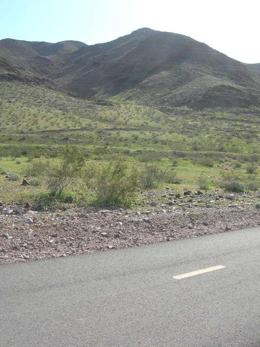
April 24th, 2010 Earth Day  Weekend –  The photo’s posted herein were taken on Saturday April 24th, 2010.  We were doing our “Trail Watch”  work along the trail from Railroad Pass Casino (MM 0.0 east to MM 32.5).  We started early at 6:30 a.m. to beat the heat and to get the best color contrast for photos.  We found the best flowers not far from the trail and best over the first mile over to the Cascata Bridge.  We also parallel the railroad tracks for most of the first two miles also.   With camera in hand, a five gallon bucket for trash, grippers, and a small street broom for sweeping rocks we set out….while picking  up trash along the tracks & trail the sun on the tracks called out to me…..  

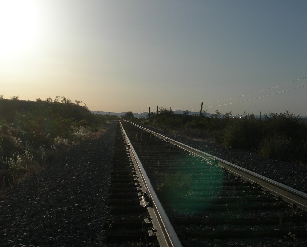
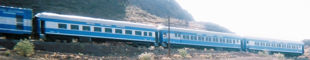
Rails to Boulder City early morning 4-24-10

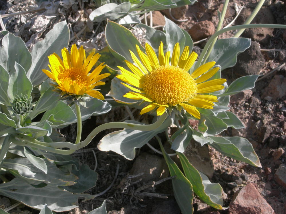
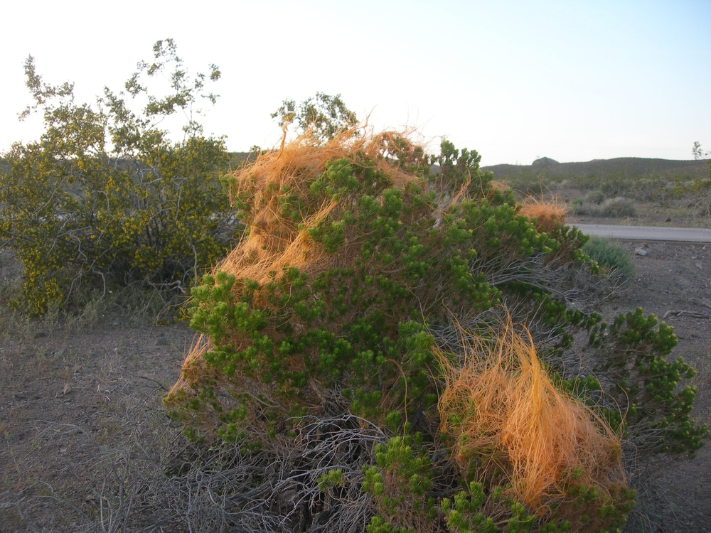
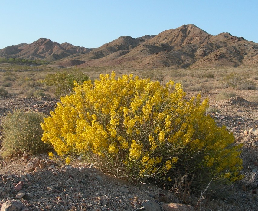
Beaver tail cactus were all along the trail most with just a bloom or two opening the best yet to come.  We also noted up on the mountain side in gullies and drainages lots of yellow brittlebush in full bloom, the entire area yellow from a distance…. the yellow contrasted with the dark brown and black volcanic rocks were awe-inspiring. 

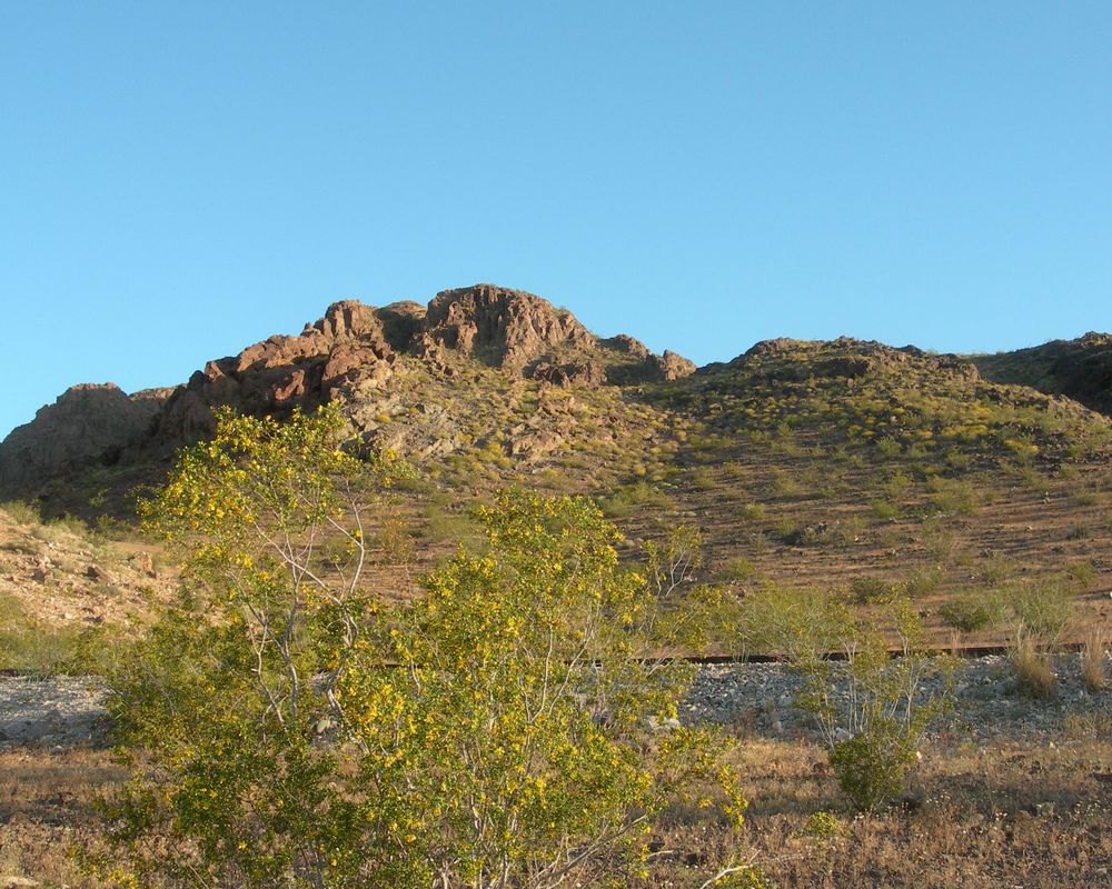
Cresote Bush in bloom with Brittle Bush on hillside 42410

Along with the wildflowers we found the droppings  of nature’s worst insect, “The Litterbug”.  In our opinion the trash came from the freeway and not trail users based on location and droppings found.  The worst item repeatedly found this day was t-paper, unrolled and stuck in bushes, you ever try to pick up t-paper?  This stuff was not used, but allowed to unroll in the wind of a speeding car then let loose…  Here is a photo of the days “litterbug’ harvest… 

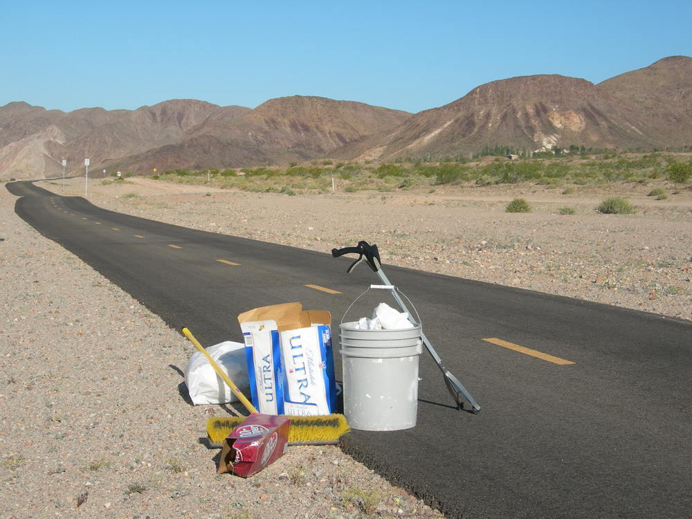
Litterbug droppings harvest along trail 42410

 Despite the litterbug sightings we did enjoy all the wildflowers along the way.  The “Stone Hedge” trailhead at Bootleg Canyon proves to be a very  interesting photo backdrop along the trail.  We discovered several small barrel cactus in full bloom on our way back to Railroad Pass…..they were on the uphill side of the trail. I’ll include one here and more in the photo gallery below.  There is much color to be seen out there and you have two weeks before it has peaked (Mothers Day); so get your camera, your hiking boots on and get out there.  Don’t just take my word for it… 

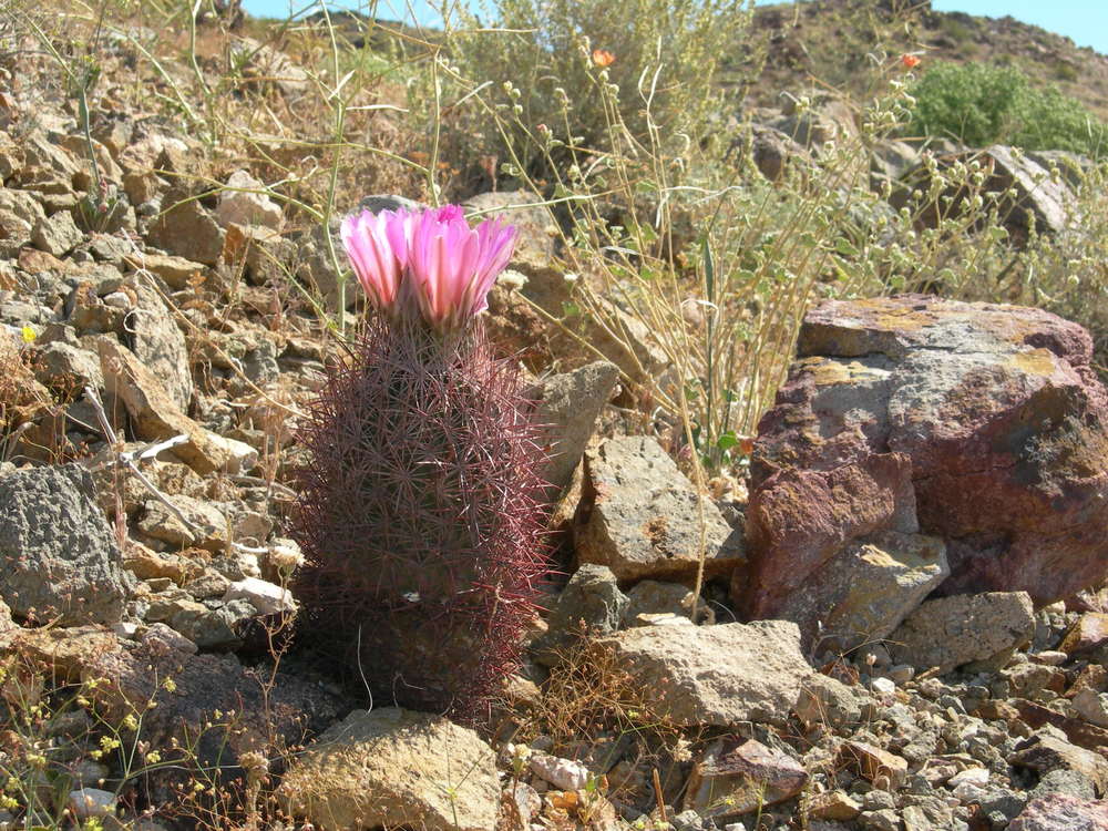
Barrel cactus two blooms RRpass 42410

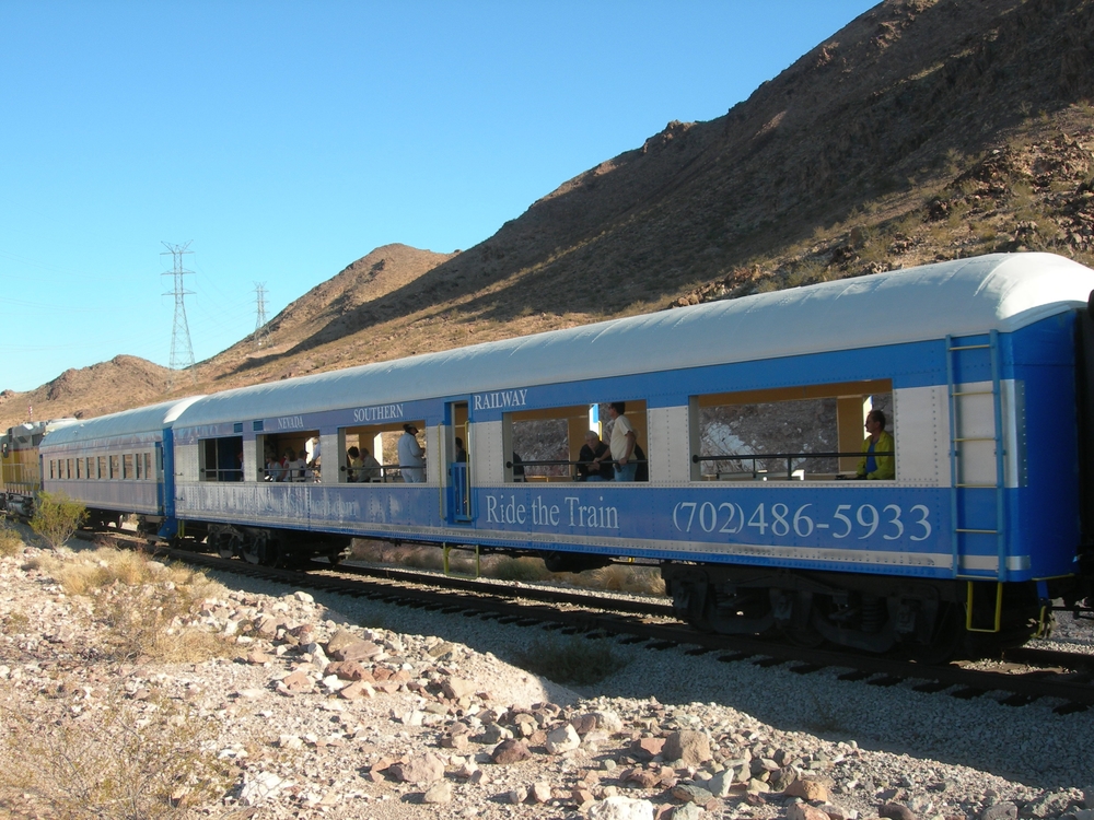
We finished our day by viewing the Southern Nevada Railways train pulling into Railroad Pass Hotel & Casino at 10:20 a.m. followed by a great breakfast at the hotel coffee shop.  Saturday mornings  in  the April desert don’t get any better….:) 

Photo Gallery of Desert blooms Railroad Pass, Nevada:


Wildflowers – “Take Photos, Leave only Footprints”

April 17th, 2010 – This quote applies to wildflowers, too.  Which means take pictures and do not pick!  This a.m. on an early morning trek on the River Mountains Loop Trail within Lake Mead National Recreation Area, we came across a nice collection of Giant Sunrays, Enceliopisis argophylla, when to our amazement we saw where someone had picked at least ten (10) flowers out of the grouping of three or four plants.  What a shame and waste….not to mention it is illegal to pick and remove any wildflowers or shrubs from a National Recreation Area.  Here is a photo of the Giant Sunray: 

Giant Sunray, Enceliopsis argophylla, April 17, 2010

This April morning was just perfect for wildflower viewing.  My wife and I entered the trail at Mile Mark 12 near the NPS fee entrance station on Lake Mead Parkway and walked east along the trail taking photos and enjoying the morning. We hit the trail at 6:15 a.m. just at sunrise so shadows were long and contrasts were good.  The creosote bush was dark green and full of yellow blooms everywhere along the trail.  We came up on a Pigmy Cedar, Peucephyllum schottii, all covered in this yellow/orange web stuff called “dodder” which is a parasite.  Here is a photo of cedar and “dodder”: 

Pigmy Cedar, Peucephyllum schottii, with "dodder" parasite growing April 17, 201-


WE found the desert about as green as it has been in recent memory and its sparse at that.  the soils are very harsh so plants  have to produce quickly before the summer heat cooks them.  We found lots of yellow flowers, several in the white and one in purple which I’ll identify in the gallery that follows.  We hiked in 2.5 miles and turned around at Mile Marker 14.5 which offers a grand overlook of Lake Mead from the Las Vegas Wash/Marina area.  The Muddy Mountains are off in the Northeast some 15-miles, Lava Butte just north about 4-miles, and southeast across the lake is Fortification Hill and Mt. Wilson.  During our 2.5 hour adventure we greeted 27 cyclists on the trail, one jogger, and one walker.  No dogs, no coyotes, no snakes, no tortoise, but it was very quiet.   I did note a lot of scat on the edge of the trail, mostly coyote I would guess. 

PHOTO GALLERY OF APRIL 17TH, 2010 WILDFLOWERS: 


Family Fun & Fido Walk – April 10, 2010 at Equestrian Park

Family Fun & Fido Walk Equestrian Park ● All ages ● 10:00 a.m.-noon ● Free Bring your family and leashed pet to Equestrian Park for Henderson Family Fun & Fido Walk. This 2-mile fun walk will be held on Equestrian Trail, a paved loop trail perfect for strollers, bikes, pets, and families. Follow the signs and participate in fun activities along the way. Kids 12 and under must be accompanied by a parent or guardian. Teens (ages 13-17) require a parent/guardian’s signature on a waiver. Advance registration and onsite registration are available.  follow link http://www.cityofhenderson.com/parks/whats-new/happening-now.php#fido

Fido Walk on lease.....file photo

The River Mountains Trail Partnership will be at the one-mile turn around booth handing out maps and trail information….see you there.

Bicycling Routes, Lanes, Trails on Google Maps “How to Find”

April 2010 – How do I find the River Mountains Loop Trail?  Where are the trail heads? Where are there connecting trails and bike routes or lanes?  Where can I see photos taken along the trail? Google Maps has the answer.  I have enclosed a power point presentation which hopefully walks you through the process.  It is still a work in progress, but it gets you out there on the trail.  Once you master this you can go anywhere across the country and try it out.

Step one:  get to Google and select Google Maps.  Step Two: Select Satellite (my preference)  Step three: search maps for ‘River Mountains Loop Trail, Henderson, Nv. 89015’    Step four:  select more and on the drop down menu click on photos & bicycling; green lines should appear indicating trails and bike routes along with photo icons.

Now the fun begins. To view the photos, place your cursor over a photo and click; photo opens with title and owner; click on by nevhiker(owner) or view in Panoramio to see larger photo and more…

Trail Heads:  To find trailheads and other points of interest go to the “New” button in green, click and a drop down of new features appears; scroll down and enable “What’s Around Here?” Little dots and buttons appear along with a listing down the left side of your screen.  you can move around the map and along the green trail and different points of interest and trail heads will appear.  click on a lettered button or a round dot to see what is there. The example in the Powerpoint (slide three) shows trail head information for “Historic Railroad & River Mountains Loop Trailhead“.  From this pop up you can get directions, link to web site, read reviews or write them, plus get additional information(slide 4).

Finally try it out and experiment  on your own and enjoy.  It is a great trail tool. Reminder Google is Beta testing this feature so it could change at anytime or even just go away.

Link  Powerpoint:  RMLT google maps – trails-bicyling march 2010

Google maps Bike Routes & Trails

Camera…….Action…..On the trail this spring

March 19, 2010 –  By tomorrow winter is over and spring is here.  Get your camera’s out and hit the trail.  With the wet winter, well over 3″ of rain, our desert trail will look like a trail through green fields.  Well at least for the next month or two. Wild flowers and wild life should be abundant.  And remember, Henderson has a photo contest each fall during National Trails Day for the best trail photos taken in Henderson.  I’ll be out this weekend with my camera and hopefully next week I can post a few green photos here to prove my point.

Wildflowers Spring 2009

You can ride your bike, but I prefer to walk/hike it that way you would miss anything….Tortoise will be out soon and so will snakes so watch out.  I got a great photo last fall of a brown Tarantula on the trail; spring last year several tortoise photos.  Other friends have photos of big horn sheep on trail etc.

RMLT Desert Green Mountains at Railroad Pass 3-20-2010


Here is a photo I took in Spring 2010 which I entered into Henderson’s Trail photo contest and won second in this category…

Wildflowers & bike riders Lake Mead April 2011

Coyote Awareness & Education part of the Solution

March 12, 2010 –  Coyote sightings, coyote stories, coyote letters to editor, coyote TV news….Mr. Coyote has been everywhere in Southern Nevada lately.  So far he has not had a staring role in a horror movie, which undoubtedly would be called  ‘”Attack of the Killer Coyotes”.  The purpose of this new post on coyotes is to help you; our readers and trail users get connected with good information about coyotes and become aware of these wild creatures.   I recently came across this very informative website for an organization called “Project Coyote”.    

Their mission is as follows:  Project Coyote promotes educated coexistence between people and coyotes by championing progressive management policies and fostering respect for and understanding of America’s native wild “song dog.”   

Please visit their website at: www.ProjectCoyote.org   

Our trail advisory council is looking into posting the following informational sign at key trail head locations to increase our Awareness of Coyotes. 


ProjectCoyote.org

Jogging and Running on the River Mountains Loop Trail


September 30, 2009 - 

Are you a runner or a jogger?  I don’t know the difference but the River Mountains Loop Trail is a great place to do both.  When I’m walking the trail I see a fair amount of joggers/runners using the trail.  I know that several local track clubs use the trail for races and practice runs.  We have marathon events all through the year using various portions of the trail for 5-K and 10-k runs.  I believe there is something for everyone’s running tastes on the 35-mile loop be it hills, flat land, curves or great views.  

Run to your hearts content on RMLT

Run to your hearts content on RMLT

If you haven’t discovered the trail yet give a try soon.  There are locations and times which get heavy use, but there is 35-miles to spread out over so give it a run. 

Jogging near Railroad Pass March 20th, 2010

Events on the RMLT: 

  • Silverman triathlon – 5th year 2009
  • Pumpkinman triathlon – 4th year 2009
  • Calico Racing 5K-10K various runs
  • Iron Girl marathon – 2nd year 2009
  • Others… 

Nevada Southern Railway


Nevada Southern Railway cars at Railroad Pass

January 25, 2010 – The  Nevada Southern Railway and the River Mountains Loop Trail share something in common. Know what it is? Right-of-way number one, but also history.  The trail and railroad run parallel through Railroad Pass east toward Boulder City for about a mile. The railroad is visible from the trail all the way up to Bootleg Canyon.  The tracks and railbed are the same ones used by Union Pacific to deliver materials and supplies to build Hoover Dam in the 1930’s.  The trail crosses the tracks twice on either side of Railroad Pass and provides live action opportunities when the train runs on weekends.  

Nevada Southern Railway trail event 100309 at Railroad Pass

The  Nevada Southern Railway is a partner in the River Mountains Trail Partnership and has participated in many Trail Day functions over the years.  We hope one day to arrange for trail and train rides that allow users to ride one way and hike or bike the other.  The  Nevada Southern Railway operates on weekends and has regular scheduled hours of operation.  The Nevada State Railroad Museum is built just off  Yucca St. in Boulder City and is where Union Pacific and U.S. Government Railroad  met and transferred materials.  The museum has restored old engines and cars as time and budget allows.  They have considerable rolling stock.  For more information check out their web site at:  http://www.nevadasouthern.com/ 

The history part of the trail and trains continues where the trail picks up the old railbed on the east side of Boulder City near Pacific Trailhead and follows the old U.S. Government Railroad rail line down through Hemingway Wash to the Lawyer Junction where The Sixes Company Railroad took over, also known as the Historic Railroad trailhead just below Alan Bible Visitor Center.  From this trailhead you can continue on to Hoover Dam via the Historic Railroad Trail or stay on the River Mountains Loop Trail heading north along Lakeshore Rd.  There is also another railroad bed heading out of the Lawyer Junction only visible to the keen eye and best seen on the north side of Lakeshore Dr. from the paved River Mountains Loop Trail. 

Railroad Gallery. Black and white are from Bureau of Reclamation public photo archives: 

Nevada Silverman Triathlon Receives Tourism Impact Award

January 26, 2010 -  The 11th Annual Henderson Economic Development Awards held on January 21st at the Ritz-Carlton awarded the Silverman Triathlon the Outstanding Special Event Award for Tourism Impact in 2009.  The following is an excerpt from the presentation and as published “In Business – CRE Special Supplement.”

Silverman Triathlon Bike Rider

Every November for the past five years, the Nevada Silverman Triathlon brings athletes from all over the world to experience the City of Henderson from all different views, whether it is in the water, on a bike or on foot.

Silverman, a race organized by Frank Lowery of Lowery’s Multisport, has been branded the toughest course in North America by six-time Hawaii Ironman Champion Dave Scott.  The full-distance triathlon features a 2.4-mile swim in Lake Mead, a 112-mile bike ride and 26.2-mile run that boasts a 2,000 foot elevation gain.

In just a short time, the Nevada Silverman has become an international phenomenon.  This year, nearly 1,000 athletes participated in the grueling competition, representing all 50 states and 15 different countries.  Additionally, race organizers partnered with Operation Rebound and the Challenged Athletes Foundation (CAF) for the Operation Rebound Silverman Half Relay for the second year in a row.

The race allowed participants to form relay teams while supporting the men and women of the armed forces.  Some of the teams had the opportunity to race with an injured veteran of Operation Rebound, an organisation that supports disabled veterans.

Silverman attracted more than 10,000 spectators who not only enjoyed the race, but also the newly enhanced free health and wellness expo.

Nevada Silverman provides nearly $4 million in non-gaming economic impact to the City of Henderson.  Lowery has made Nevada Silverman a world-class race, allowing Henderson the opportunity to be the host location for the International Triathlon Union (ITU) World Championships in 2011.

 …………………………..

Frank told me the 2011 ITU event could attract 5,000 -6,000 athletes and over 30,000 spectators.  Economic impact to the city could triple that of 2009.  This event will need full Henderson Community Support.  ARE WE UP TO THE TASK?

Our hat is off to Frank and entire crew for a job well done.  The 112-mile bike course uses about 7-miles of the River Mountains Loop Trail through East Henderson and the Trail Partnership has sponsored the Bike Course Aid Station #10 for five years.,,,rmltman

Discovery Trail – History, Wildlife, Forces of Nature, Educational Tool


DISCOVERY TRAIL –  Yes, I believe the River Mountains Loop Trail is a discovery trail.  It is a great place for families to discover the desert world around them.  Young kids need a chance to explore and discover the world around them.  This is free for the taking sort of speaking.  At the various trail heads history or nature is intrepreted  for the user.  Along the trail waysides are being designed an installed telling about the history, wildlife, plants or some force of nature.  Plus there is the experience of discovering nature for yourself right there on the trail.  I tell many of my friends and hiking buddies that if they really want to see the world around them, then “Take a Hike” in it. 

Trails are all about discovery….what is around the next bend?…over the next hill? under the next tree or bush?  what is that old structure over there?…where do those power lines come from….where are they going?…what type of cacti?…bird, rabbit, snake, bug, lizard, rock, bush, etc? is that.  Do animals really live in the desert?  What types?

If one does a little reading and research before heading out on the trail you will be amazed at the local history right here in your back yard.  One of the goals of the River Mountains Trail Partnership is to help all trail users discover what the River Mountains has to teach us.   Take a little time read some of the BLOG categories and discover.  I have been at this about 18 months and have only discovered the tip of the iceberg.

Many of you ride the trail on bikes for recreation and exercise, but you are missing the discovery.  It is my personal goal over the next year to walk/hike every mile of the trail and personally discover all it has to offer.  How about you?

Here are just a few things along the trail to be Discovered and in no particular order:  HOOVER DAM…SADDLE ISLAND…FISH HATCHERY…RED MOUNTAIN…ALUNITE MINE…RAILROAD PASS…BOOTLEG CANYON…FLOOD CHANNELS… POWER LINES…GOLD MINES….THREE KIDS MINE…MOVIE FILMED HERE…MAGIC TREE…BMI WATER LINE…WATER RECLAMATION…COYOTES…BIG HORN SHEEP…BEAVER TAIL CACTUS…CRESOTE BUSH…TEXAS ACRES…SIXES COMPANY…HISTORIC RAILROAD…DESERT TORTOISE…MANGANESE MINING…AND SO ON.

« Previous Page
Next Page »

Recent Blog Posts

Dogs on the Trail

Las Vegas Hiking Trail Featured in Article

Las Vegas Hiking Trail Featured in Article

Pacifica trail head Boulder City on the new trail website.

New Trail Website

Be Sure to Visit

Latest Posts on Facebook

Comments Box SVG iconsUsed for the like, share, comment, and reaction icons
Author Avatar
River Mountains Loop Trail
3 weeks ago

www.facebook.com/share/p/1Hz7o2W4xo/ ... See MoreSee Less

Link thumbnail

Register for a Smart Cycling Class | League of American Bicyclists

bikeleague.org

Post Title
View on Facebook
· Share
Share on Facebook Share on Twitter Share on Linked In Share by Email
View Comments likes 0 Shares: 0 Comments: 0

0 CommentsComment on Facebook

Author Avatar
River Mountains Loop Trail
2 months ago
Come and join us on

Come and join us on March 14th! ... See MoreSee Less

View on Facebook
· Share
Share on Facebook Share on Twitter Share on Linked In Share by Email
View Comments likes 3 Shares: 0 Comments: 0

0 CommentsComment on Facebook

Author Avatar
River Mountains Loop Trail
3 months ago
Love our trail!

Love our trail!🎙️ New Podcast Episode Alert 🚨

Ever wondered what it takes to maintain 34 miles of paved paradise? 🌵

In this episode of The Best Dam Podcast, Howard is joined by Paul Grube, President of the River Mountains Loop Trail Partnership. Paul takes us behind the scenes of one of Southern Nevada’s most beloved outdoor assets—the River Mountains Loop Trail.

www.bouldercitychamber.com/connecting-communities-34-miles-of-cycling-hiking-and-history-on-the-r...

From its "happy hour" beginnings in the late '90s to becoming a world-class 34-mile loop connecting Boulder City, Henderson, and Lake Mead, this trail is a testament to community vision.

Highlights include:

🐢 The funny story of the "moving rock" (spoiler: it was a tortoise!).
🐑 Tips for spotting bighorn sheep and other local wildlife.
🛠️ How the Partnership acts as the "eyes and ears" to keep the trail safe.
🚲 Why you don’t even need your own bike to get started.

Whether you’re a hardcore cyclist or just love a morning stroll, you won’t want to miss Paul’s insights on this local treasure! ☀️
... See MoreSee Less

View on Facebook
· Share
Share on Facebook Share on Twitter Share on Linked In Share by Email
View Comments likes love 6 Shares: 1 Comments: 3

3 CommentsComment on Facebook

Load more

View Full-Sized