River Mountains Loop Trail

Facebook icon

  • Home
  • About
  • Trailheads and Maps
    • Trailheads in Boulder City
    • Trailheads in Henderson
    • Trailheads in Lake Mead NRA
  • History
    • Geology of the River Mountains
    • A -Desert Tortoise – Do’s & Dont’s
    • Keep It Clean
  • Blog
    • Recently on Facebook
  • Contact
    • Contact List
  • Donate

Dogs on the Trail

Ruffing it Out

Written by Jocelyn Brown

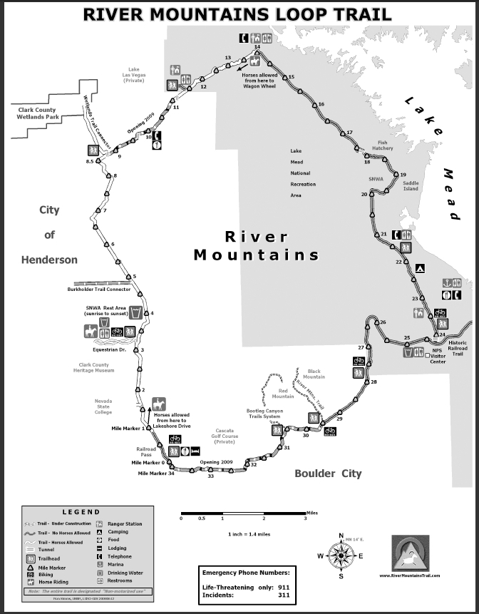
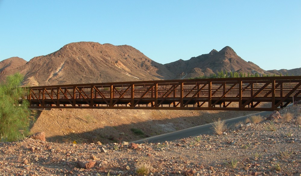
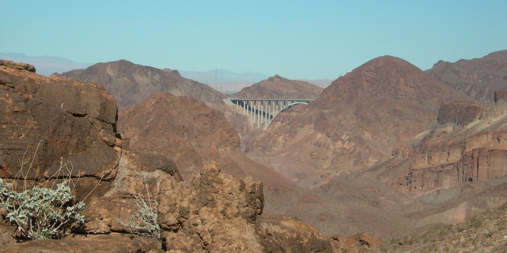
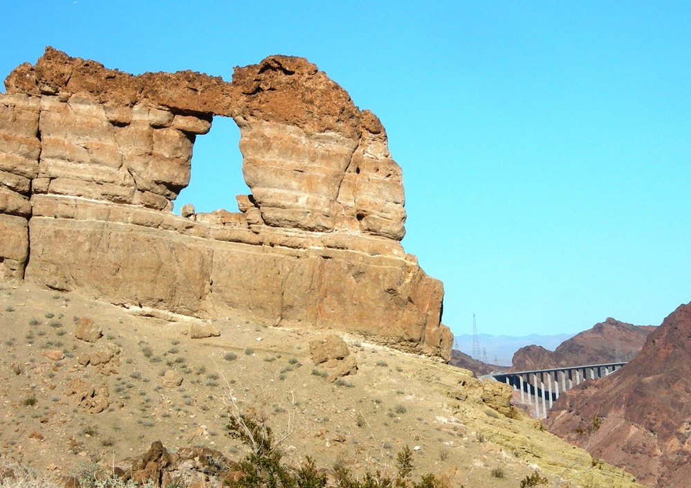
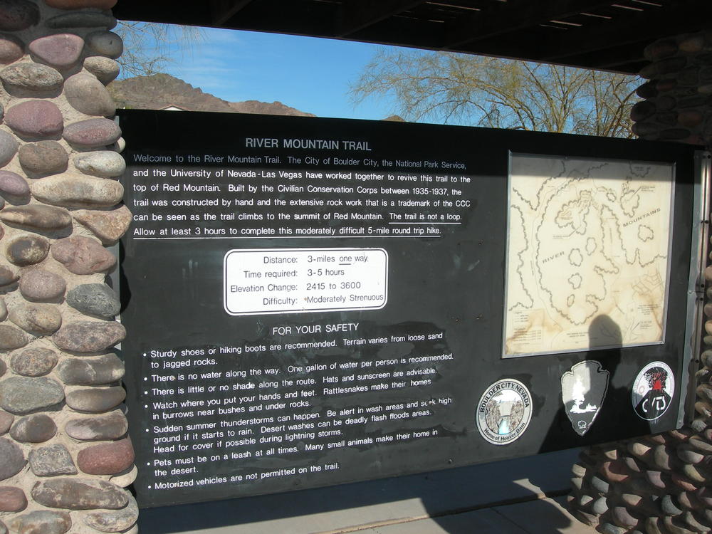
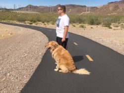
With winter coming to a close and spring quickly approaching, now is a great time to hit the trails with your whole family. Dogs on the trail are OK so don’t forget to bring Fido! The River Mountains Trails are designed for dogs and humans alike. Here are some tips and activities that will help him join in on the fun.

Tracking and Sniffing Games

Tracking and trailing are what make up the very essence of a dog if he can smell, he can track. The teaching of tracking and sniffing has become a sport and a fun game for owners and their furry pals. Unlike other dog-human activities, tracking puts the dog in charge. With the variety of wildlife located along the River Mountains Loop Trail, it is a great place for a dog to start, or to increase his ability to track different animals. However, be sure that your best bud helps to protect the wildlife on the trails and doesn’t frighten or bother animals such as the turtles in the area. Look but don’t touch.

Biking with your Buddy

River Mountains houses a trail called the Bootleg Canyon Mountain Bike Trail, which is a great location to mountain bike with Fido. It’ll increase your dog’s endurance and strength, as well as provide you both with excellent views of the desert. However, when biking in these conditions you need to pay attention to your dog’s health. Don’t go too fast or too far ahead and always watch out for him. You can buy bicycle attachments that connect your dog to the bike which ensures that he does not run too close or get hurt. To beat the heat, you must make sure he has enough water. The Bootleg Canyon Mountain bike trail has restrooms and water a half a mile along the route, to allow you to rehydrate and fill up for the rest of the journey.

Hiking the River Mountains

Hike to the top of the River Mountain, and take in the views with man’s best friend. You should get him a “dog pack” which not only allows him to carry some of the load, but also keeps him cool. For a one-day hike, these packs can include a collapsible food dish and water, and have a pocket to insert a cooling pack in. A handle at the top also allows you to easily hang onto him if you need to. However, keep an eye out for your dog’s feet. Some dogs have sensitive feet and you need to make sure they don’t overheat or get cut by cactus needles. If he likes them, you can buy him booties to protect his precious paws.

Preserving the Trail

It is important that you and Fido take steps to preserve the trail for others that will come after you. Make sure you stay on the marked paved paths to avoid disturbing flora and fauna, and keep your dog from getting hurt by stray cactus needles. Keeping your buddy on a leash will help him stay on the trail, and prevent them from colliding into bikers and joggers. Also always remember to clean up after you pet. Sometimes duty calls, but it is important that we do our part to preserve the environment and leave it just the way we found it.

Follow the links below for information mentioned in this story.

http://www.dogplay.com/Activities/tracking.html

http://www.particularpaws.com/blogs/news/5-amazing-rescue-dogs/

https://www.rei.com/learn/expert-advice/hiking-dogs.html


Las Vegas Hiking Trail Featured in Article

Las Vegas Hiking Trail Featured in Article

Quiet thrills just beyond Las Vegas

Writer Robin Soslow wrote a fantastic article for The Roanoke Times called “Quiet thrills just beyond Las Vegas” that just happens to be about our favorite Las Vegas hiking trail.

She captured the essence of the River Mountains Loop Trail…

Las Vegas Hiking Trail Featured in ArticleThe River Mountains Loop Trail rings rugged peaks that rise about 15 miles southeast of Las Vegas. Completed in late 2012, this trail gives Nevada an earthy spectacle to rival its world-famous Strip, a free hiking-biking jackpot of million-dollar views: rolling hills, tunnels, the Las Vegas Bay, Lake Mead, Hoover Dam, even Strip casinos twinkling like gemstones in the distance.

Striking scenery along the 12-foot-wide asphalt path, which has earned designation as a National Recreation Trail, attracts leisure hikers, runners and cyclists. Its aridity and elevation changes draw competitive athletes. Train here and race terrain will feel like easy street. The RMLT is no longer a locals’ secret. “We receive inquiries from around the world about this trail,” said Mauricia Baca, executive director of the Outside Las Vegas Foundation.

Here’s one more example of Robin’s article about the River Mountains Loop Trail:

The landscape’s flocked with cactus, sunray flowers, swaying palms and the “Magic Tree,” a cottonwood near the mile marker 13 nicknamed for its ability to thrive in the middle of nowhere. Residents, most active early morning, include bighorn sheep, desert tortoises and skittering lizards. Midday, animal sightings will generally be dogs being walked on a leash. There’s Mojave Desert heritage, too, with interpretative signs — good excuses for water stops — and a historic pipeline that first brought water from Lake Mead to the Las Vegas Valley.

Check out the entire article about this wonderful Las Vegas hiking trail: Quiet thrills just beyond Las Vegas

New Trail Website

Full color map of the River Mountains Loop Trail on the new trail website.Yes the new trail website for River Mountains Loop Trail is finally here. Users have been asking for a fresher more interactive web site. The new site brings together Facebook, Blogging and web information all in one.  Maps and trail heads was a key part of the new design. Working with our web creator, Steve Rypka of GreenDreamWeb, we were able to give you all our current maps and create trail head information including photos of each and Google Maps to find your way. Thank you Steve.

Photos play a key part in telling the trail story so keep your eyes open for new photos from the editor and fans who post their adventures along the River Mountains Loop Trail.

We wish all ” Happy Trails” and many of them.

Your web design team….

Mountain Lake Park

Mountain Lake Park Trailhead

Mountain Lake Park Trailhead

New Trailhead and Hub:

Mountain Lake Park has quietly come on line for public use, even though its official dedication is still weeks away. The park and trailhead have been years in the planning, design and construction. It is located on Golda Way in Henderson, NV. The park was originally planned as a trailhead only on the south of Lake Mead Parkway to provide access to the River Mountains Loop Trail. Due to the power line  corridor, right-of-way issues and funding, the design, location and amenities took a while to firm up. As it turns out the wait was will worth it.

The Mountain Lake Park and Trailhead provides access and serves as a connecting hub to three trail systems including the River Mountains Loop Trail.

Event Permit Matrix for River Mountains Loop Trail

Silverman Connector web

Silverman Triathlon bike portion of event

Because the River Mountains Loop Trail has become “found” and is popular for special group events we have had to develop a permitting process to handle events.

There are four permitting entities which have different requirements. Below is a permit matrix which will get you started.  We want everyone to enjoy the trail and we wish to prevent conflicts with multiple events planned for the same day and same segments/portions of the trail.

Also we can not have everyone applying their own version of trail markings on the trail so rules and guidelines are  now in place.  And one of the main reasons for permits is to not over permit the use of the trail such that the average Joe & Jane can go out on a Sunday trail ride with family and enjoy it.

The River Mountains Loop Trail is already home to several large Marathon and Triathlon events on an annual basis. The lead times listed in the matrix could be much longer if you require a specific date so we recommend you start early and contact all entities involved.

In order to best read the permit matrix click on the thumbnail images below:

River Mountains Loop Trail Map

Best Place to Ride a Bike in Las Vegas

We made it…..The Review-Journal’s  2011 Best of Las Vegas  “Best Place to Ride a Bike”  R.J.’s choice.   They didn’t list the entire trail, but that is probably because the writer-rider hasn’t ridden the entire trail system as yet.  I concur with this selection from Railroad Pass east to Boulder City as it has much to look at from a views point-of-view; plus you have the historic train rides on the weekend to look forward too.

Trail Bridge route to Boulder City from Railroad Pass

You will also see that the River Mountain Trail is selected as “Best Place to Hike”; this  is actually a different trail but shares a trail-head in Boulder City. This trail was built by the (C.C.C.) Civilian Conservation Corp. circa 1934 -1936 and is a six mile round trip hike to the top of Red Mountain in the River Mountains.  You will find a more detailed write up elsewhere in this BLOG.

O’Callaghan – Tillman Bridge at Hoover Dam

New bridge near Hoover Dam

Bridge at Hoover Dam: Night lights.

This was sent to me by a friend. Truly a fantastic photo of the bridge construction.  The completed bridge has become just as big a tourist attraction as the dam, well almost.  The bridge has its own parking lot and viewpoint and provides photo ops of Hoover Dam never-before available to the average person until now.  One can access the Dam and Bridge taking the old Hoover Dam road to the visitor center….or if you want a hiking/biking adventure take the Historic Railroad Trail down to the Hoover Dam Parking garage at the visitor center.

Hike to Liberty Bell Arch

On January 17th, 2011 some good friends and I went on a hike to the Liberty Bell Arch on the Arizona side of the Colorado River below Hoover Dam.  The 2.5 mile hike route provided several views of the new O’Callaghan – Tillman Memorial Bridge located upstream about 3 – miles.

O’Callaghan – Tillman Memorial Bridge 3.5 miles downstream 11711

 The Bridge was also visible from the Liberty Bell Arch.  We could only get 1/2 the bridge into the photo due to the angle of the river and we would have to be flying out over the river to get the full bridge in view.

Liberty Bell Arch & Bridge in Back ground…3.5 miles north

This was my first crossing of the bridge since its opening in November 2010. Speed was 55 MPH and we just zipped across at 8:00 a.m. in the morning.  You can not see the Colorado River or Hoover Dam while driving across the dam, so do not try.  On the Nevada side of the river you have to take the Hoover Dam Access road(the old road) down to either the new visitor parking at the bridge to walk out on the bridge on the Hoover Dam side only; or drive on down to parking at the dam in order to get photos of the new bridge and visit the dam. There are no bike lanes on the bridge for riding across, but you can walk across on the walkway.

To ride a bike to the Hoover Dam or Bridge viewing one can access via the Historic Railroad Trail at Alan Bible Visitor Center located approximately 4.0 miles west of Hoover Dam.  This ride will provide great views of Lake Mead while passing through five large railroad tunnels on the way out to the dam. The trail is wide and the tread is native material with a very gentle grade until the very end. The last 1/4-mile drops down to an access point to the Hoover Dam visitor center where you can either walk the bike down a Switchback walkway or park and lock at the top.  The Bureau of Reclamation has not yet made a direct connection from the Historic Railroad Trail to the Bridge viewing area, so be careful crossing roads.

LIBERTY BELL ARCH TRAIL: Link to article by Deborah Wall in The View – http://www.viewnews.com/2011/VIEW-Jan-11-Tue-2011/CentennialHills/41270190.html   if you clip this article and follow it, you will find yourself at the Liberty Bell Arch on the Colorado River.

River Mountain Trail…circa 1935-1937


Kiosk trail head sign at River Mountain Trail Head

The River Mountain Trail often times gets confused with the River Mountains Loop Trail and visa versa.  That is because they are both trails in the River Mountains.   The original River Mountain Trail was built by the Civilian Conservation Corps (CCC) between 1935-1937 during the time of Hoover Dam construction.  The trail head is located just downhill on Nevada Hwy past the National Park Service warehouse. The trail head was built and developed by the City of Boulder City, the National Parks Service, the University of Nevada Las Vegas who worked jointly to revive this trail to the top of Red Mountain.  The trail was constructed by hand and has extensive rock-work that is a trademark of the CCC which can be seen as one hikes to the summit of Red Mountain.  This trail is not a loop, but 3-miles one way making for a six-mile round trip.  Allow 3-5 hours to make the hike and enjoy the views.  You will experience an elevation change from 2415 to 3600 feet.  The Park Service has rated this hike as Moderately Strenuous. 


With the completion of the River Mountains Loop Trail through Boulder City late 2009/early 2010 this trail head became a shared trail head for both trails.  As yet no map or kiosk for the loop trail has been installed but the trail head is at Mile Marker 30.

This trail head is primitive – no water or restrooms.


A Destination Trail

Wildflowers and Lake Mead

Spring wildflowers line the River Mountain Loop Trail with Lake Mead in the background.

After posing the question on Facebook about whether the users thought the River Mountains Loop Trail was a “Destination Trail,” I have to concur that it is. My brief research doesn’t really define what a destination trail is so I’m setting out to determine what makes this a destination trail. So I went to Wikipedia and started with:

A Destination Hotel is a hotel whose location and amenities make the hotel itself a destination for tourists, rather than merely a convenient place to stay while traveling through or visiting the area for other reasons.”

So if I do a little word-smithing we get:

A Destination Trail is a trail whose location and amenities make the trail itself a destination for tourists.”

So in other words the trail itself is the primary reason for the visit or trip, and the amenities (the hotel, the restaurants, etc.) add to the reason to visit the trail. I have also heard the phase “World Class Trail.” Let’s explore some of the reasons why this trail would be considered a Destination Trail.

  • It’s a 34-mile paved loop trail, non-motorized, and 12-foot wide.  Suitable for street bikes, mountain bikes, jogging, running, hiking, walking, roller-blades, 5-k’s, 10-k’s, marathons and triathlon and even horse-back riding.
  • It’s both a rural and urban trail connecting the communities of Henderson, NV. and  Boulder City, NV. to Lake Mead National Recreation Area and Hoover Dam via connecting Historic Railroad Trail.
  • It circles/loops around the River Mountains which is full of wildlife year round and wildflowers in the spring, offers unobstructed views of Lake Mead, numerous mountain ranges, and of course the one and only Las Vegas.
  • Speaking of wildlife the River Mountains is home to one of the largest and most productive Desert Big Horn Sheep populations in the Western USA.
  • The trail is also a trip into and through history of Southern Nevada. Kiosks and waysides along the trail system tell the story.
  • Speaking of amenities one will find five (5) different hotels and resorts connecting to the trail system, something for everyone’s taste.
  • The trail also connects you to other destinations along the way such as Historic Downtown Boulder City; Lake Las Vegas Resorts; Hoover Dam; Wetlands Park Trail system; and multiple trail connections into the Henderson Community and  Las Vegas.

Wow. I just sold myself on a trip to visit the River Mountains Loop Trail and I only touched on some of the big reasons. I like the scenery, the views, the peace and quiet, the huge wide open spaces and the solitude one experiences along the trail. There is something for everyone’s trail needs.

Where else in the world can you jump on a bike and ride on a trail system and see two of the world’s engineering marvels at the same time? I’m referring to Hoover Dam and the Tillman – O’Callaghan Bridge.

Hoover Dam & Tillman – O’Callaghan Bridge construction 2009

Next Page »

Recent Blog Posts

Dogs on the Trail

Las Vegas Hiking Trail Featured in Article

Las Vegas Hiking Trail Featured in Article

Pacifica trail head Boulder City on the new trail website.

New Trail Website

Be Sure to Visit

Latest Posts on Facebook

Comments Box SVG iconsUsed for the like, share, comment, and reaction icons
Author Avatar
River Mountains Loop Trail
4 days ago

We are EXTREMELY short on survey responses for statewide outdoor recreation needs!

Please click the link below to take the Statewide Comprehensive Outdoor Recreation Plan (SCORP) survey (about 5-7 minutes). The SCORP is a 10-year plan that establishes priorities to address unmet needs for public outdoor recreation land throughout the state. This is vital information for continued funding and outdoor recreation access in Nevada!

... See MoreSee Less

Link thumbnail

2027-2036 Nevada Statewide Comprehensive Outdoor Recreation Plan (SCORP) | State Parks

parks.nv.gov

Find your next adventure at parks.nv.gov
View on Facebook
· Share
Share on Facebook Share on Twitter Share on Linked In Share by Email
View Comments likes 2 Shares: 1 Comments: 0

0 CommentsComment on Facebook

Author Avatar
River Mountains Loop Trail
4 months ago
The River Mountains

The River Mountains Loop Trail detour will begin 8/4/25 and last for 30 days to install waterline adjacent to the RMLT between reservoirs R7 &R12 (approx. 2,500 feet) along with two trail crossings. The waterline trench is within a few feet of the edge of trail and would pose a hazard to the trail traffic being in close proximity to the open trench and equipment. Several options were considered by the City of Henderson, and the attached detour was selected as the safest and easiest physically option to the public while keeping the trail functional and on similar pavement. ... See MoreSee Less

View on Facebook
· Share
Share on Facebook Share on Twitter Share on Linked In Share by Email
View Comments likes wow angry 15 Shares: 5 Comments: 11

11 CommentsComment on Facebook

Author Avatar
River Mountains Loop Trail
5 months ago
RMLT DETOUR! The Lak

RMLT DETOUR! The Lakemoor development will be doing work in the near future that affects the trail. Attached is the detour route that has been approved. The work is anticipated to be at least 2 months (60 days), and the work is anticipated to start on July 21, 2025. ... See MoreSee Less

View on Facebook
· Share
Share on Facebook Share on Twitter Share on Linked In Share by Email
View Comments likes wow angry 9 Shares: 0 Comments: 5

5 CommentsComment on Facebook

Load more

View Full-Sized